 |
 |
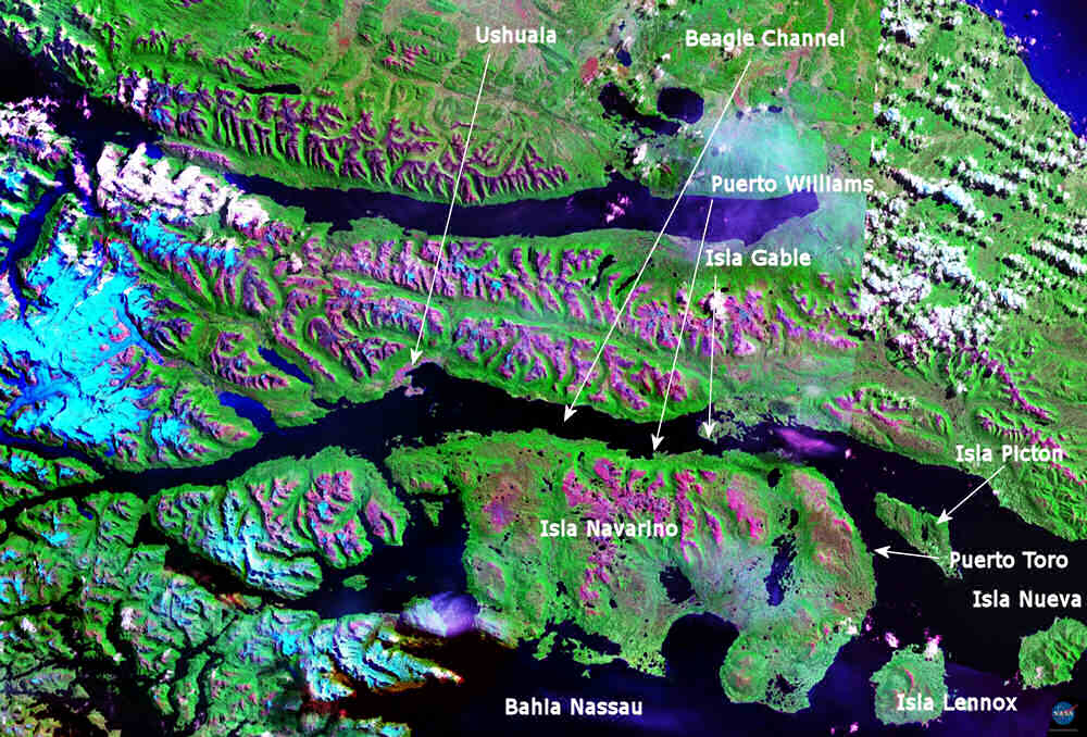
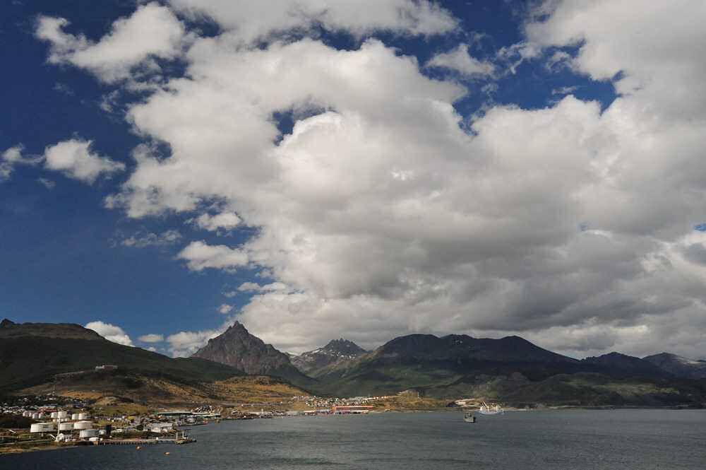
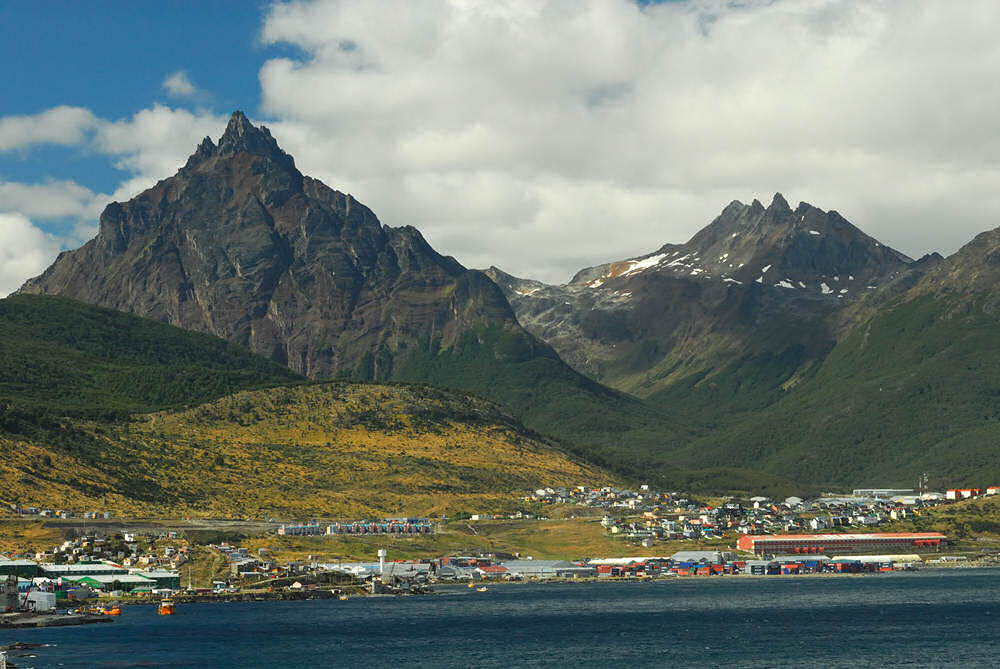
After leaving Isla de Hornos and Cape Horn, the Splendor sailed east and then north before we and anchored for the night in the Beagle Channel where we took on a pilot to bring the ship through the Beagle Channel to Ushuaia. We were moored in Ushuaia (unfortunately on the south, which ended up being the windward side of the pier) before dawn. I got to watch the sunrise over the mountains of Tierra del Fuego and reflecting on the placid waters of the Beagle Channel itself. From our balcony, I also had a great view of the Punta Observatorio lighthouse across the harbor.
|


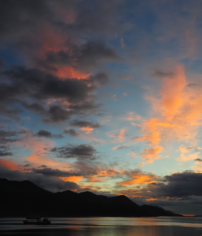
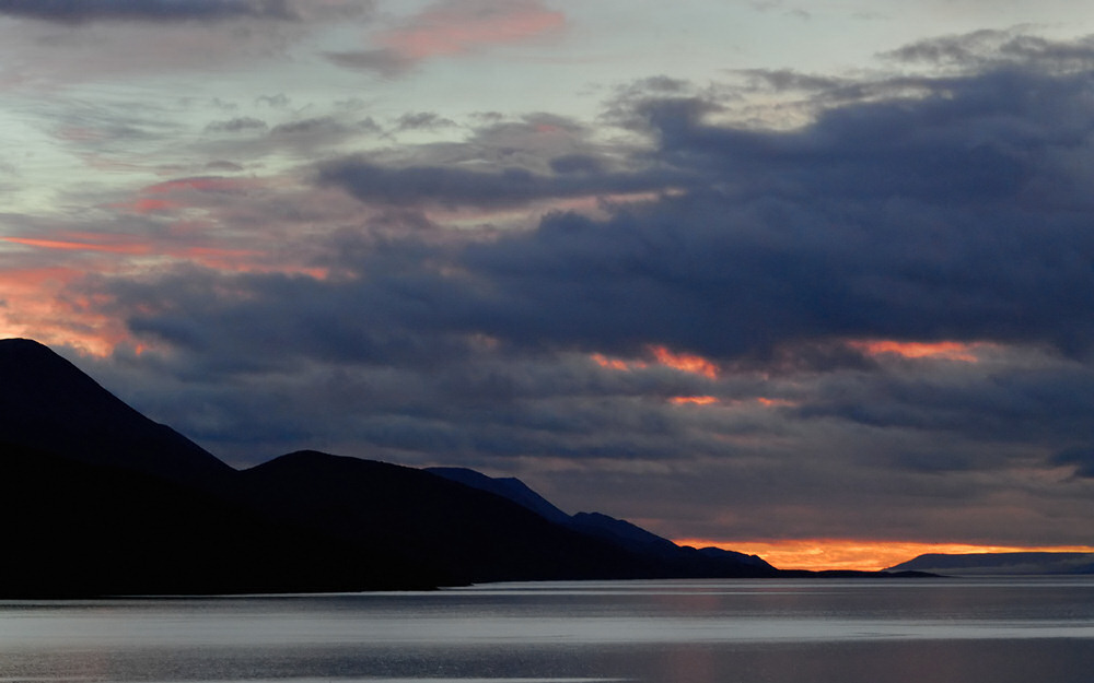
Sunrise the morning we arrived in Ushuaia was truly spectacular! As the sun came up in the east, the color grew subtly by degrees and I found myself wishing that I had been able to bring a tripod along on trip. Unfortunately, that wasn't possible, which was a real bummer.
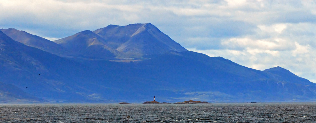
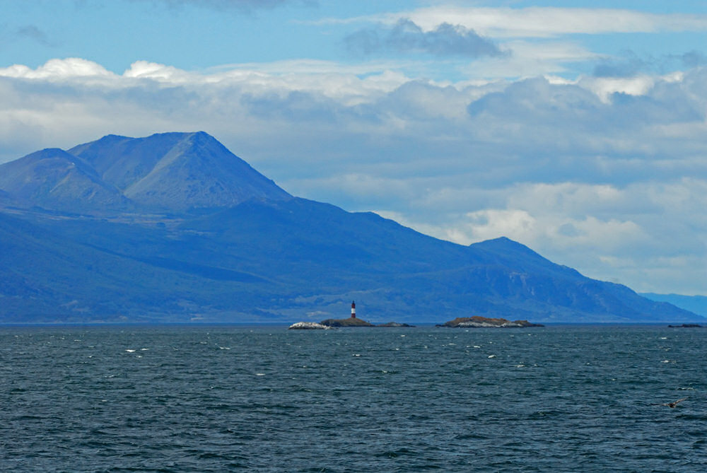
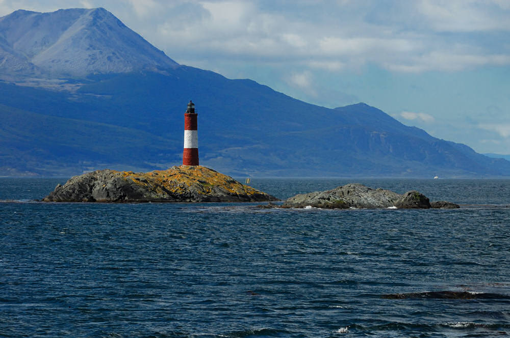
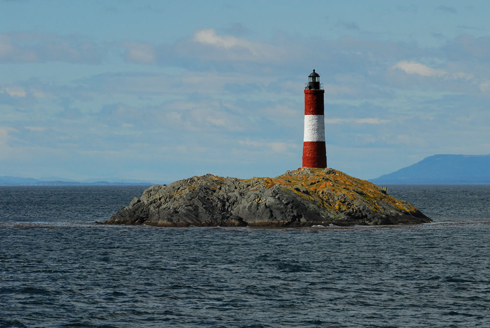
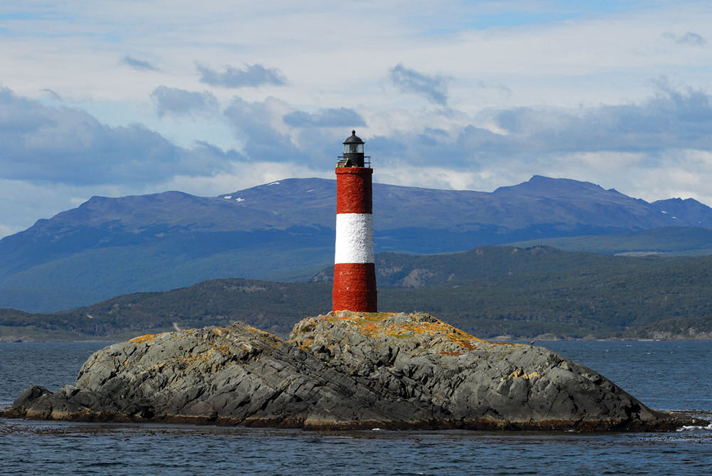
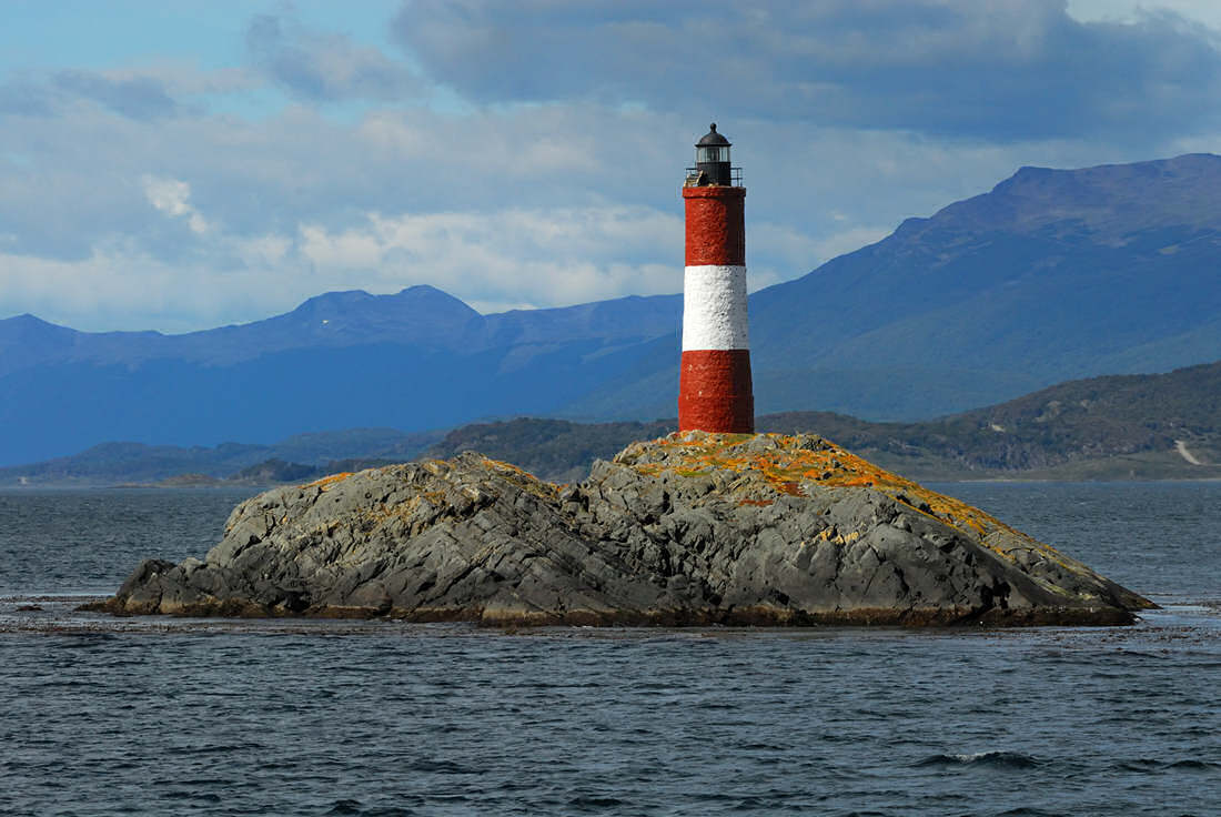
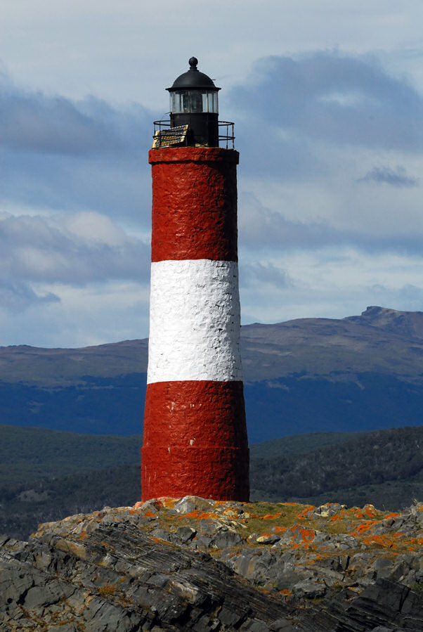
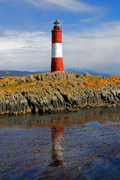
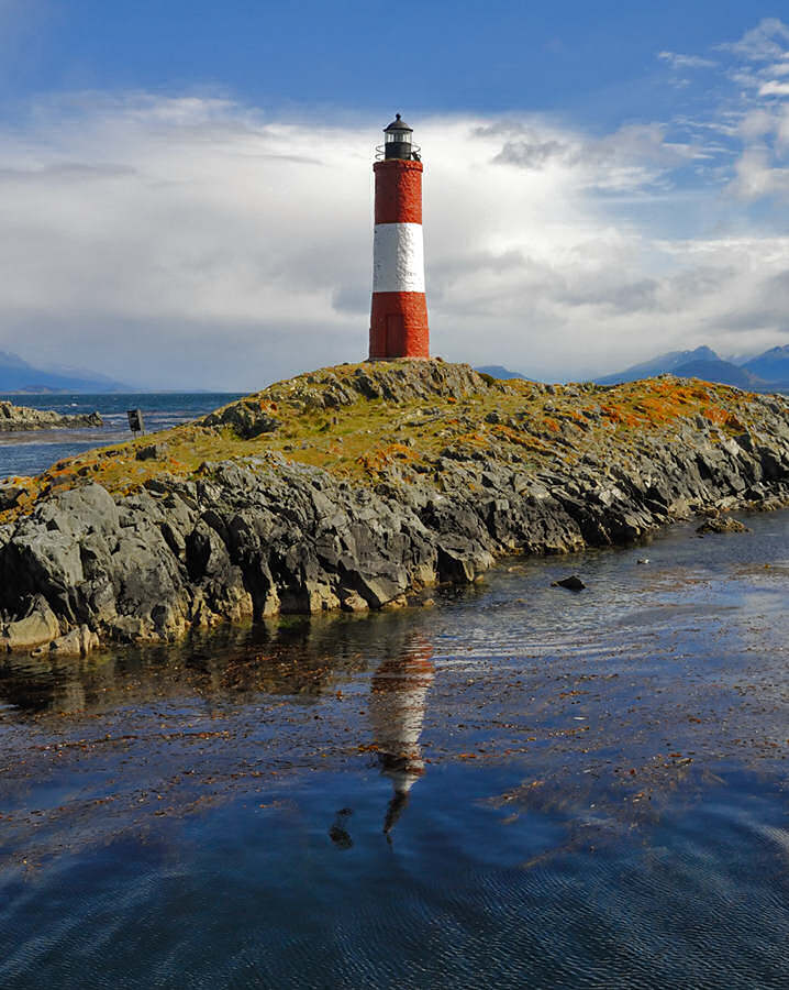
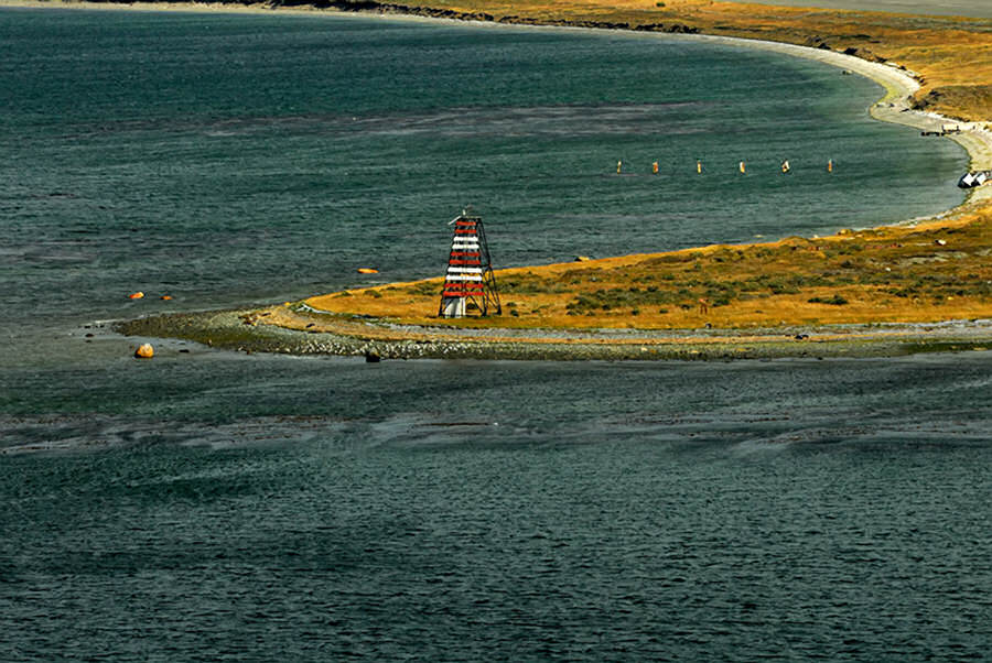
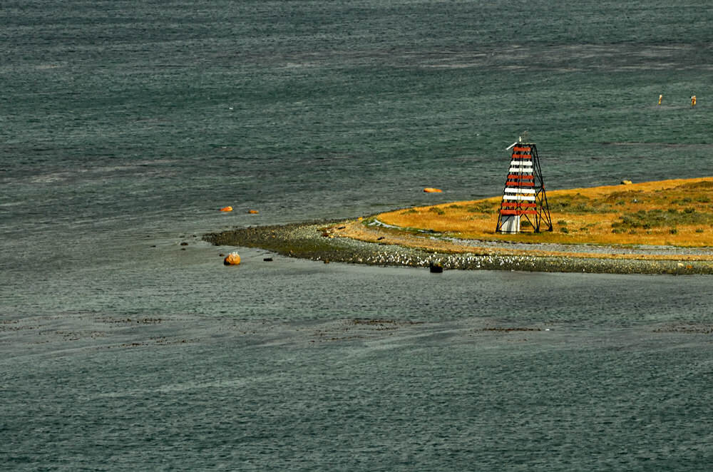
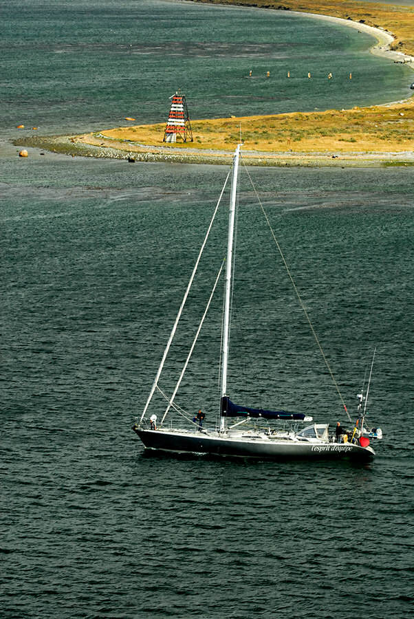
After I finished photographing, we ended up having a leisurely breakfast on the Lido deck of the Splendor before getting ready for a day trip out to Tierra del Fuego National Park, with a return on a catamaran on the waters of the Beagle Channel that would carry us east past Isla de los Lobos (Sea Lion Island) and Isla Pajaros (Bird Island) as far east as Faro Les Eclaireurs, a visually dramatic lighthouse standing atop a small islet in the Beagle Channel that represents a navigational hazard. From there the captain of the catamaran took us back to Ushuaia in the lea of the Marial Range's peaks along the north side of the Beagle Channel and past Escarpados, otherwise known as the Faro Playa Larga light.
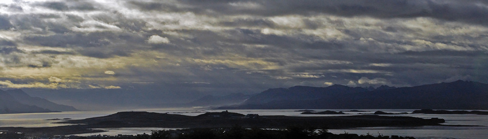
When we departed the pier in Ushuaia by bus, we were headed west on Argentina's Route 3, which is probably better known as part of the Panamerican Highway. At one point, when the road climbed into the foothills, we had an absolutely spectacular view back across the Beagle Channel and parts of Ushuaia.
|
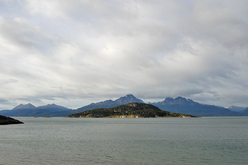
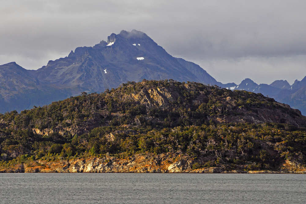
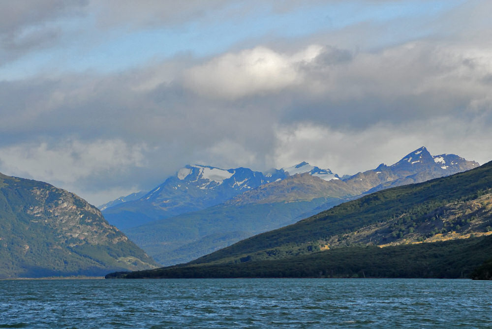
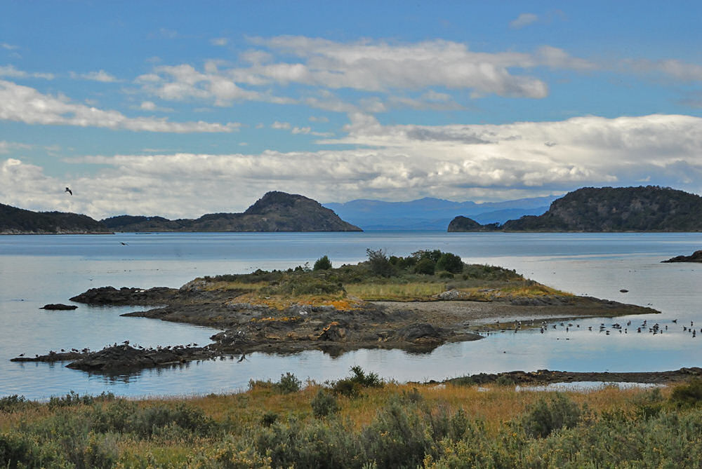
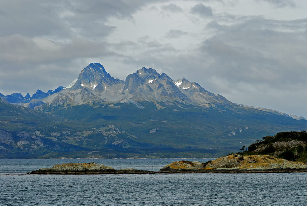
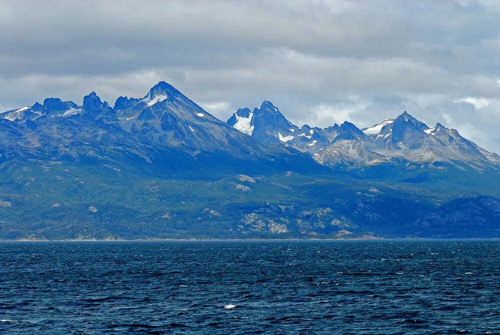
Our
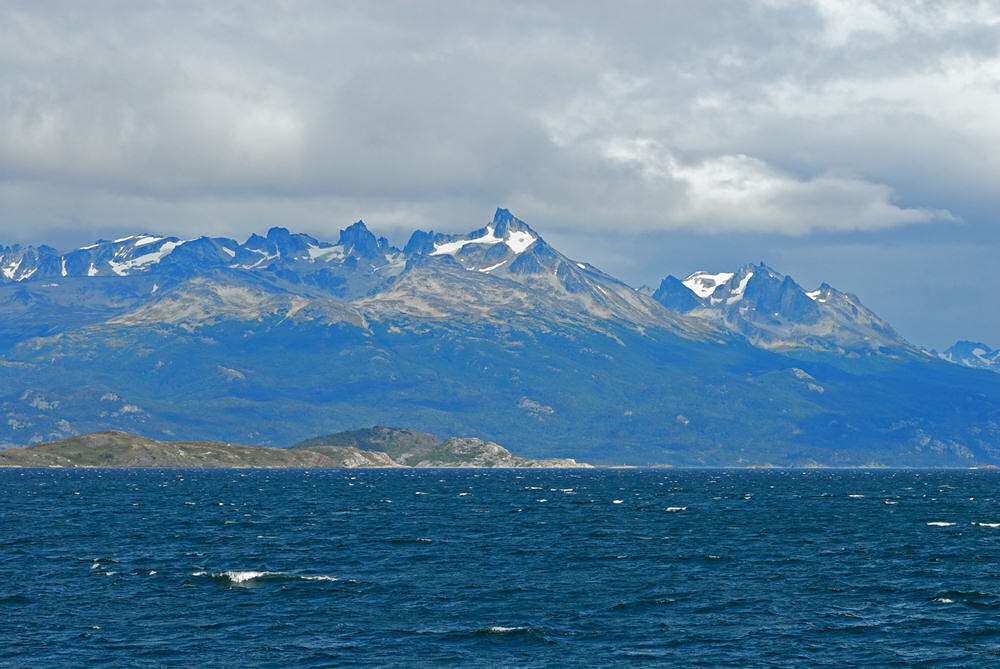
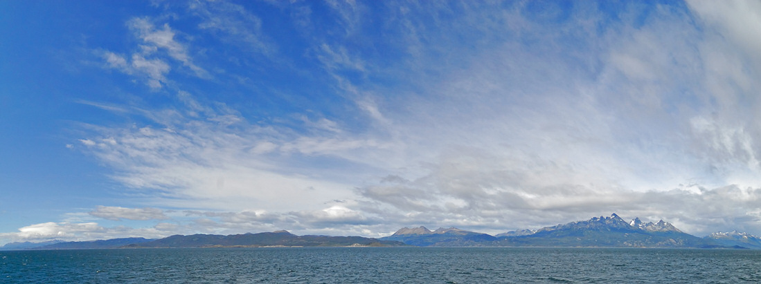
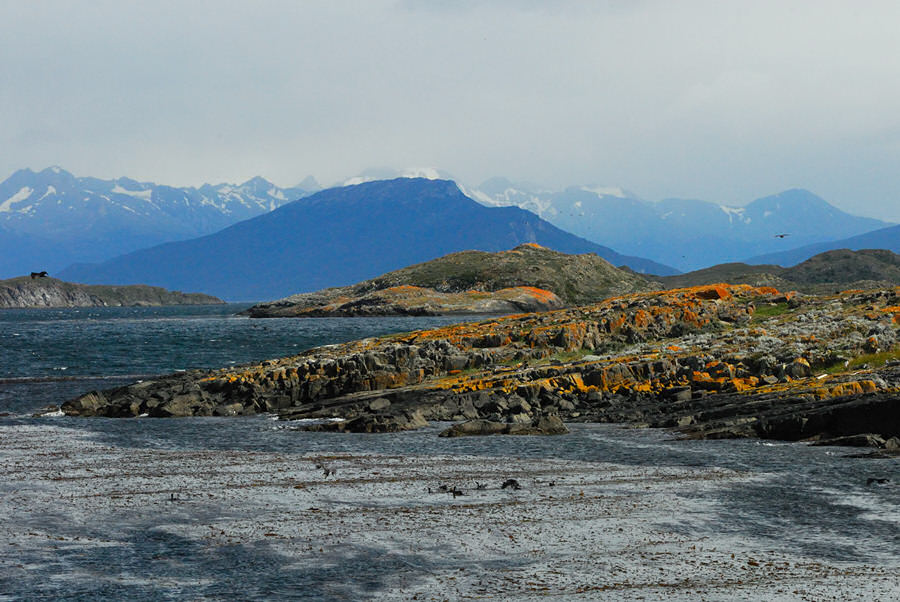
first top inside of Tierra del Fuego National Park was at Bahia
Ensenada, which opens out into the Beagle Channel. There were
some absolutely spectacular views of the shoreline and across the
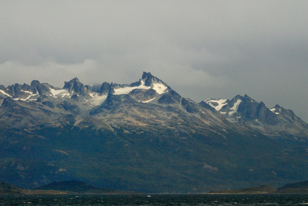
channel to the mountains in the Chilean islands. The image
to the right is looking more or less southwest. Argentina
is in the foreground on the right. The snow capped peaks in
the distance are on the Chilean island of Isla Gordon. The
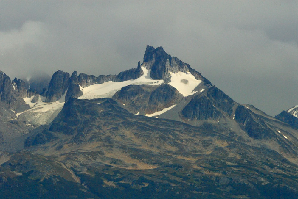
two images below are looking directly across the Beagle Channel
toward Chile. |
click image for a larger view |
click image for a larger view |
click image for a larger view |
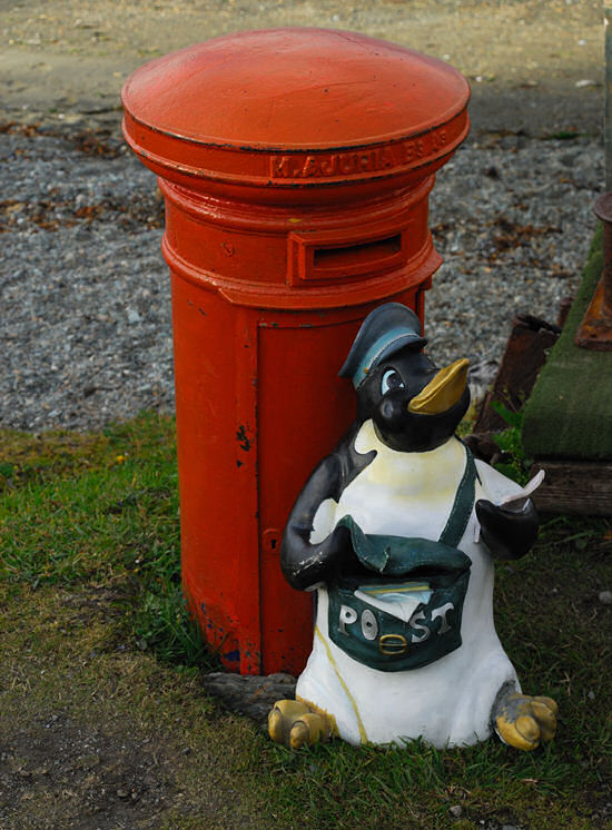 |
I've seen photographs occasionally of the classic old red British phone booths in some rather odd locations and have periodically thought that I would have photographed it too if I had come across it. That said, while I don't honestly ever remember having photographed a mailbox before where the mailbox was the specific intent of making the image, at Bahia Ensenada there is the most seriously cool mailbox I've ever seen and this was absolutely the subject of the photo! As we went deeper into Tierra del Fuego National Park we had the opportunity to get out of the tour bus and walk some in the park. Photographing from a tour bus through the windows leaves a lot to be desired to say the least. The park, on the other hand is spectacular and somewhere you could trek to your heart's content with plenty of solitude if you want it.
|
click image for a larger view |
click image for a larger view |
The two images above were shot in Tierra del Fuego National Park. The image on the left is just some peak on the front of which the lighthing fascinated me. The image on the right is looking up along Lago Roca. The moutains off in the distance beyond the lake, which continues for quite a distance beyond the point that project into the lake from the right, are in Chile.
|
|
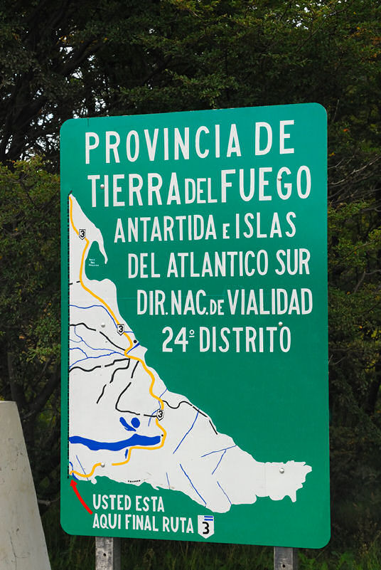 |
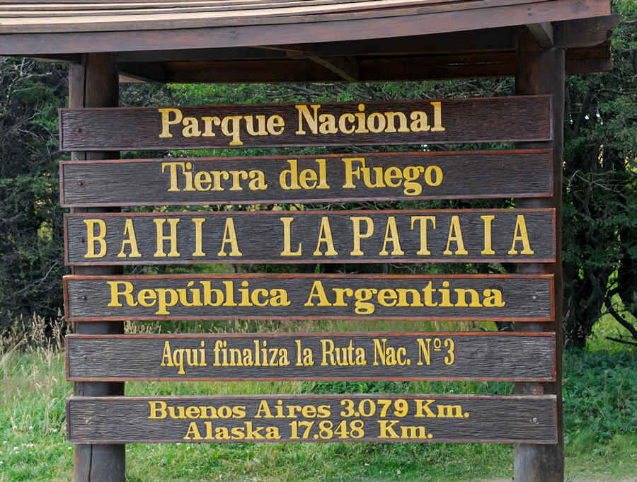
When you get to the end of Route 3 in Tierra del Fuego National Park, there are several signs that immediately grab your attention. The sign to the left read Province of Tierra del Fuego - Antarctica and Islands of the South Atlantic. Down in the lower left corner it says you're here, the end of Argentine Route 3. That bit of knowledge, in and of itself probably woudn't mean too much to very many people, but the next sign you see, larger and more formal drove the importance of where we were home!
The sign below tells you that you're at the very southern end of the Panamerican Highway, a mere 17,848 Km from Alaska... or if you prefer, 11,000 miles and change! |
|
|


|
|
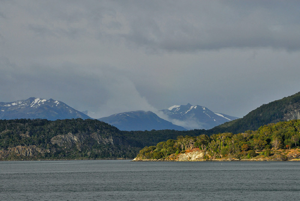
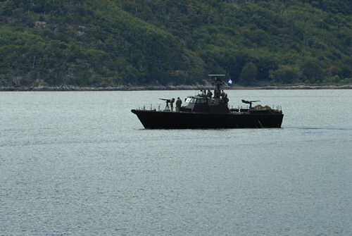
From the end of the road, you walk a short distance on a dirt path to get to an observation platform overlooking Bahia Lapataia. The Beagle Channel is through the notch between the island in the middle ground. The moutnains in the distance are Chile, most probably near the western end of Isla Navarino. At times, you forget that you're in another part of the world and displays of military force can be more common, such as the armed Argentine Navy gunboat to the right that cruised Bahia Lapatia while we were waiting to board our catamarn for a trip back to Ushuaia on the Beagle Channel.
|
 |
After everyone was aboard the catamaran, we departed, our course taking us out into the Beagle Channel through the notch in the photo of Bahia Lapataia above. The scenery of the mountains of Isla Gordon and then Isla Navarino rising up from just south of the Beagle Channel is truly spectacular! It's hard to cull a few photographs from the number that I shot to add to this web page, but... Anyway, one of my favorites happens to be the image below. Others maybe someone else's favorite of those that I've posted on this page. What a spectacular location to have ultrawide and fisheye lenses! |
|
|
|
click image for a larger view |
click image for a larger view |
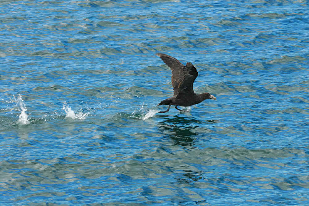
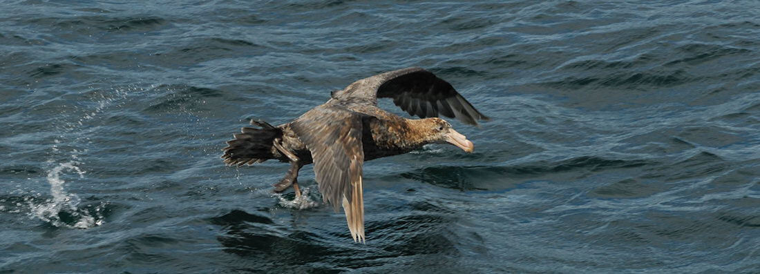
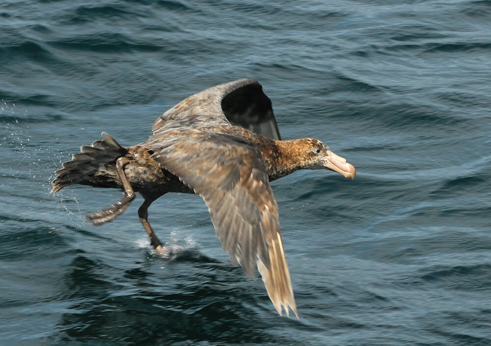
As we made our way east on the waters of the Beagle Channel, not only was the scenery spectacular, the waterbirds were abundant. The photo to the right and those below are some shots of giant petrels taking flight. While there is no real way to get a sense of scale, these are very large birds, with the wing span of adults reaching up to 6 feet, and a face that one friend told me only a mother giant petrel could love...
|
click image for a larger view |
|
|
click image for a larger view |
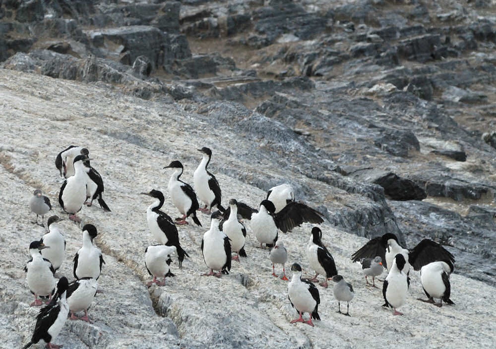
Cruising
east along the Beagle Channel, we went past Ushuaia heading for
Isla de los Lobos (Sea Lion Island). While the name of the
island suggests that you're going to find sea lions there, you first
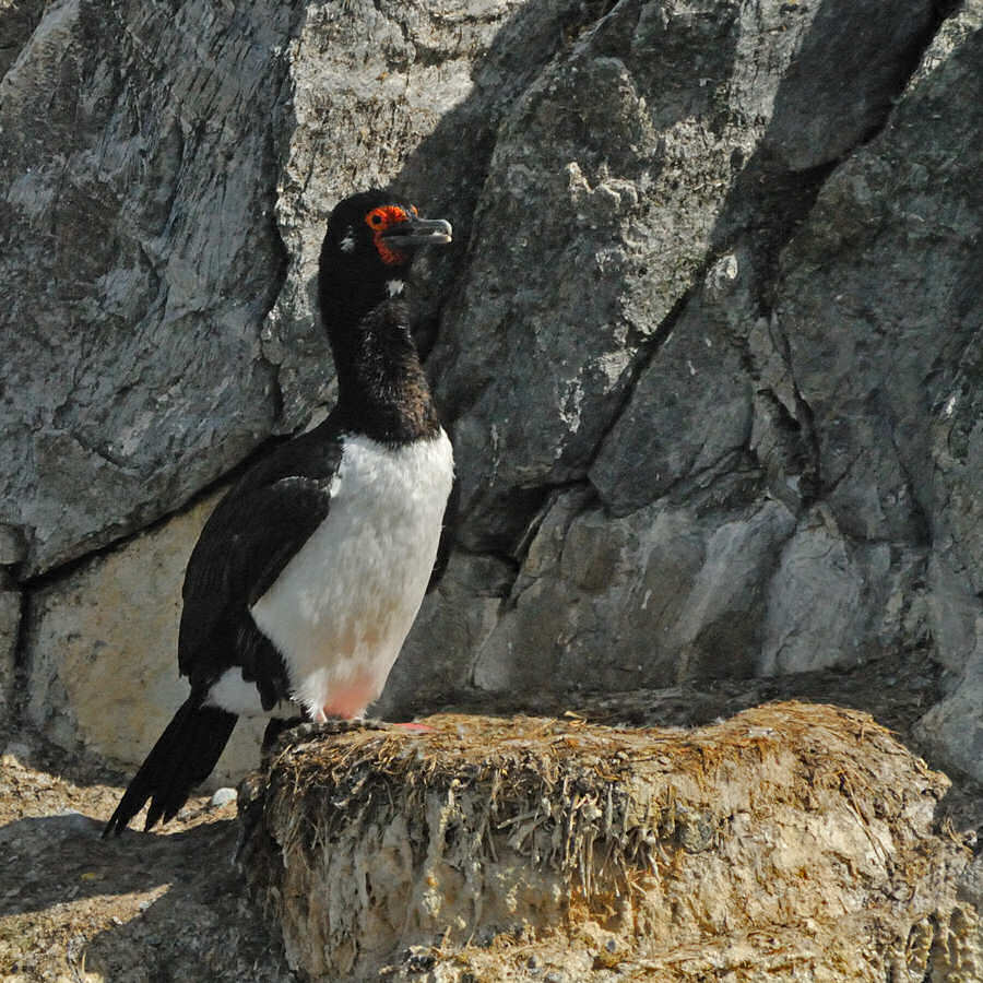
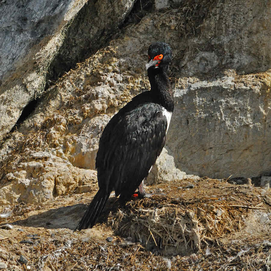
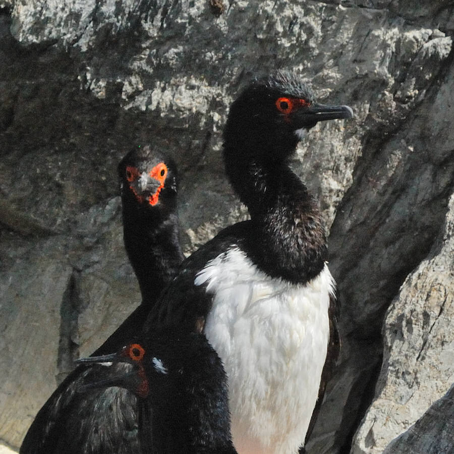
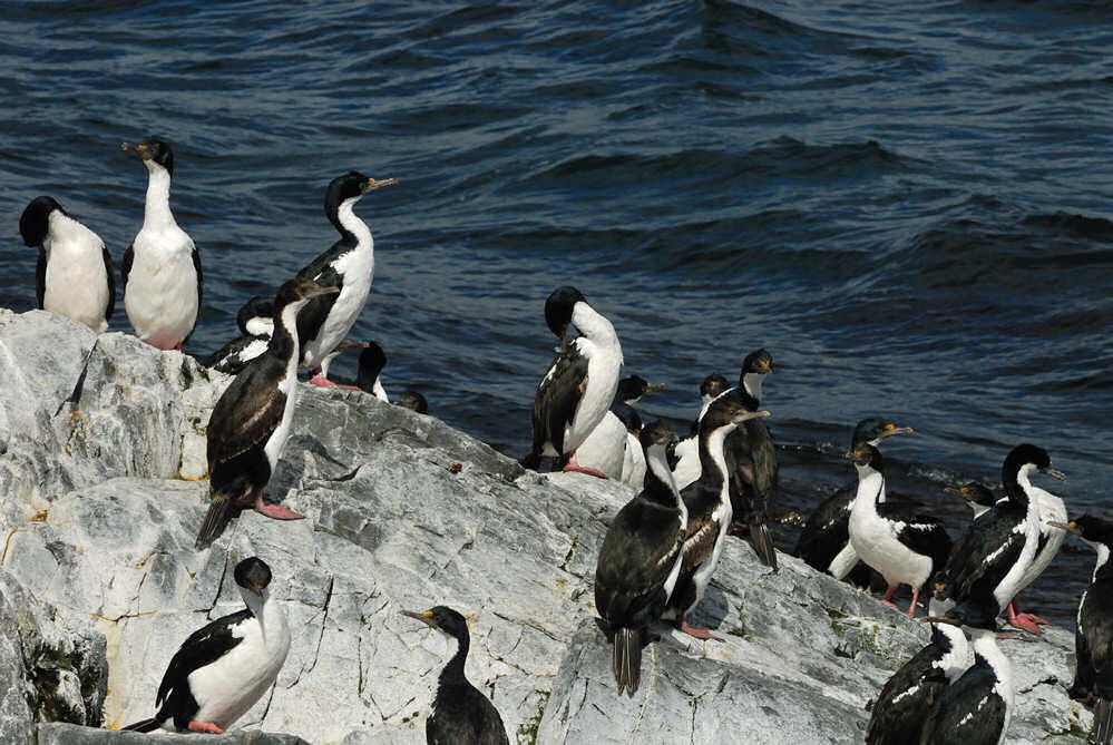
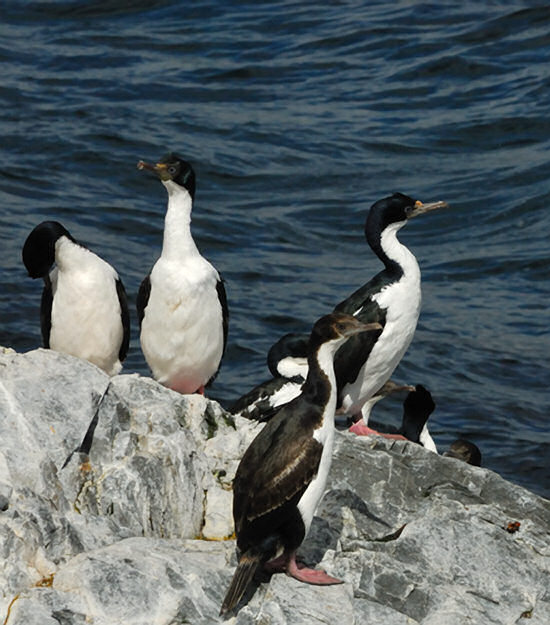
get an abundance of cormorants -- these are birds that look a lot
like penguins but they can fly. |
 |
|
|
click image for a larger view |
click image for a larger view |
click image for a larger view |
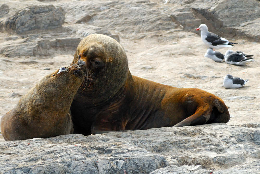
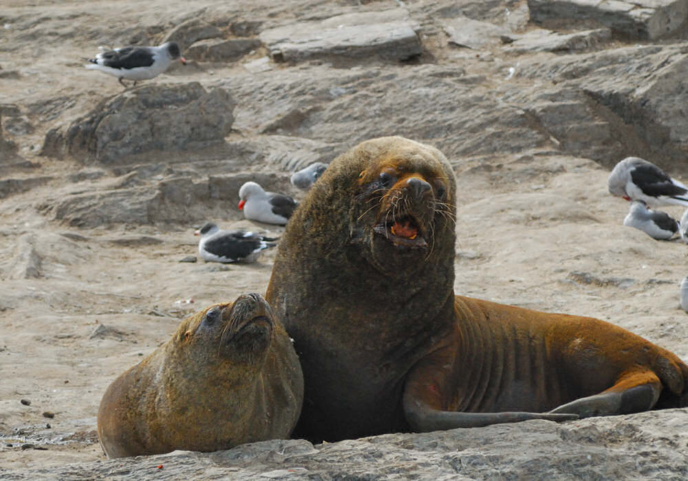
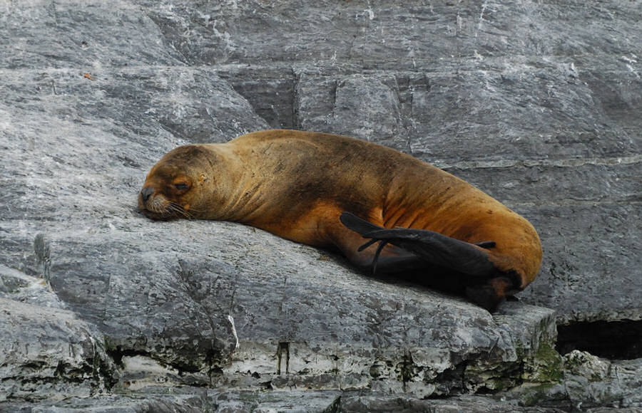
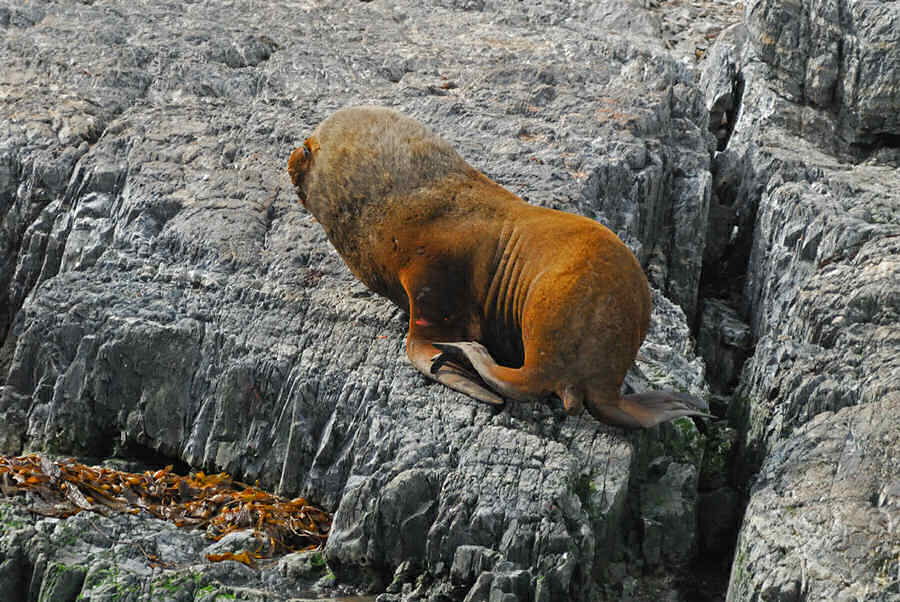
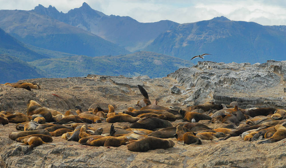
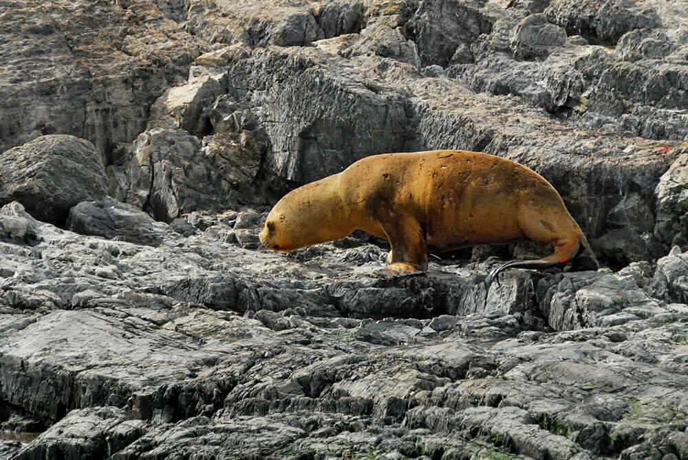
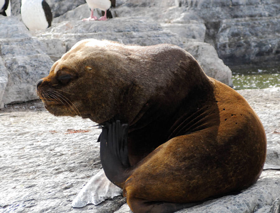
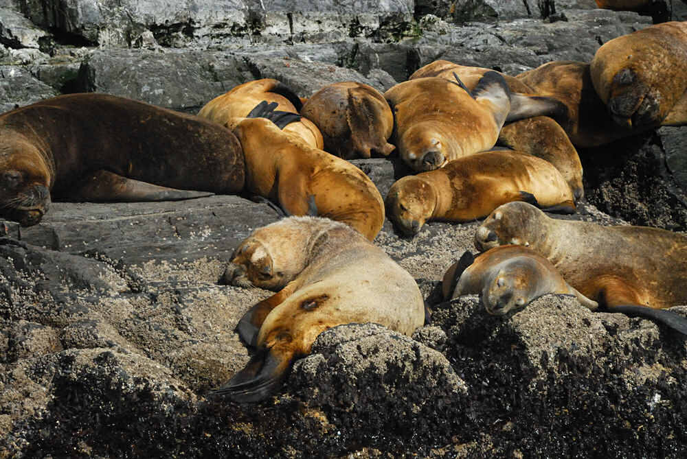
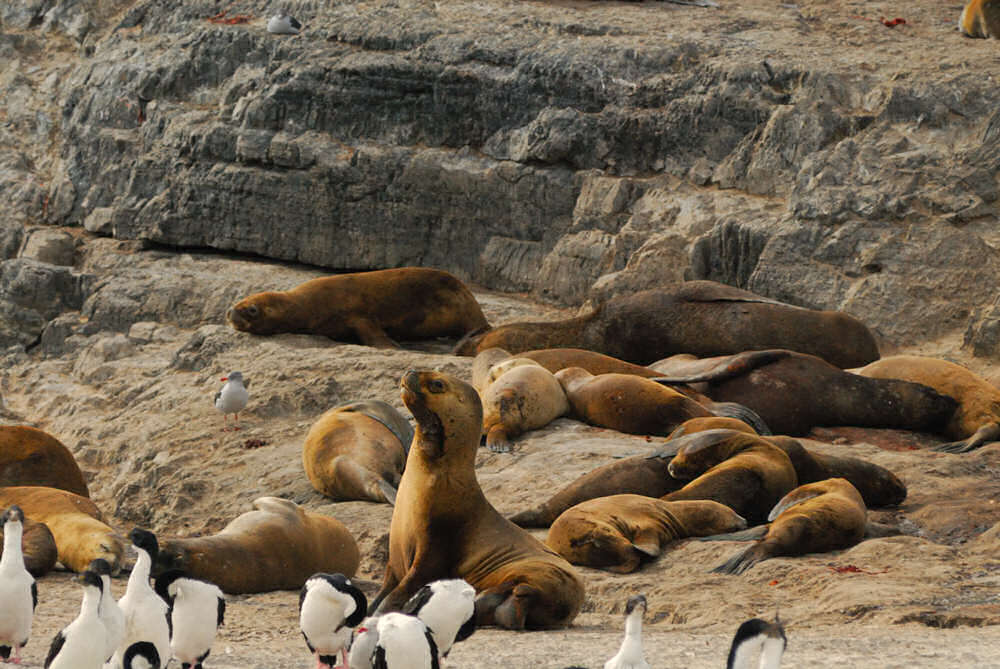
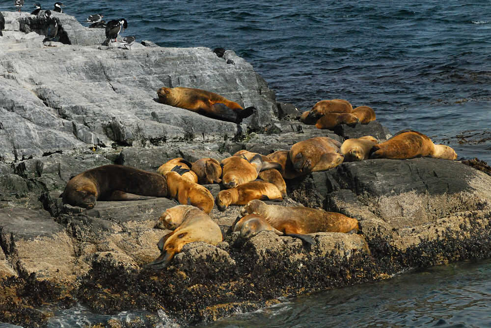
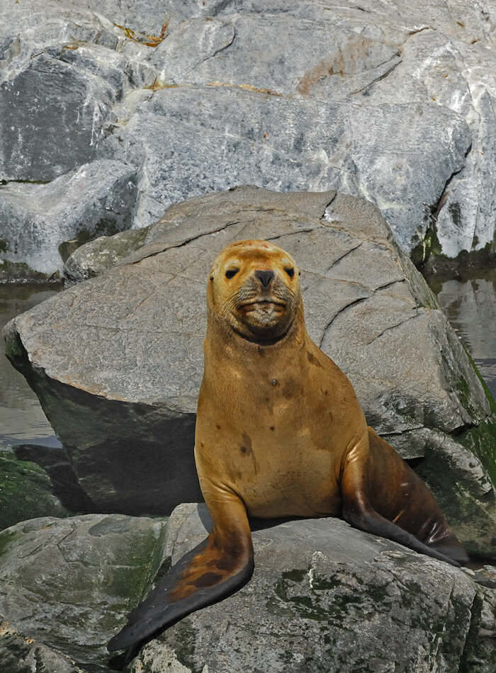
While we were idling a few feet off the rocky shore of Isla de los Lobos, we passed a sea lion couple. I ended up getting three shots of them a few seconds apart which could have made for a better sequence if I had tried. I've captioned these as I thought appropriate...
|
"Adoration" |
"The Kiss" |
"So Who Are You Lookin' At?" |

click image for a larger view |
click image for a larger view |
click image for a larger view |
click image for a larger view |
|
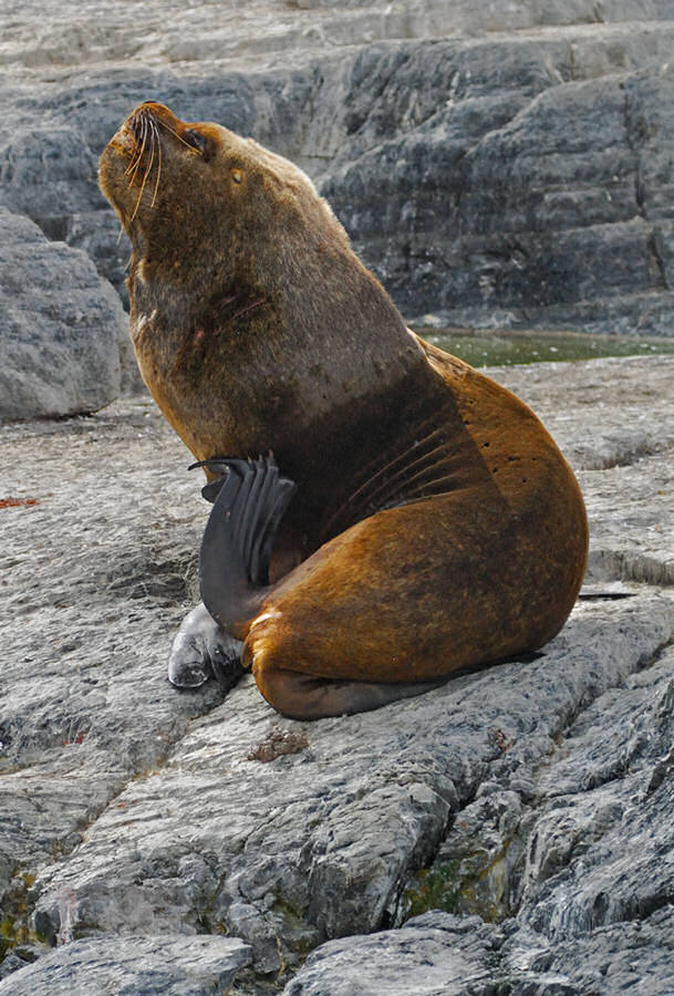
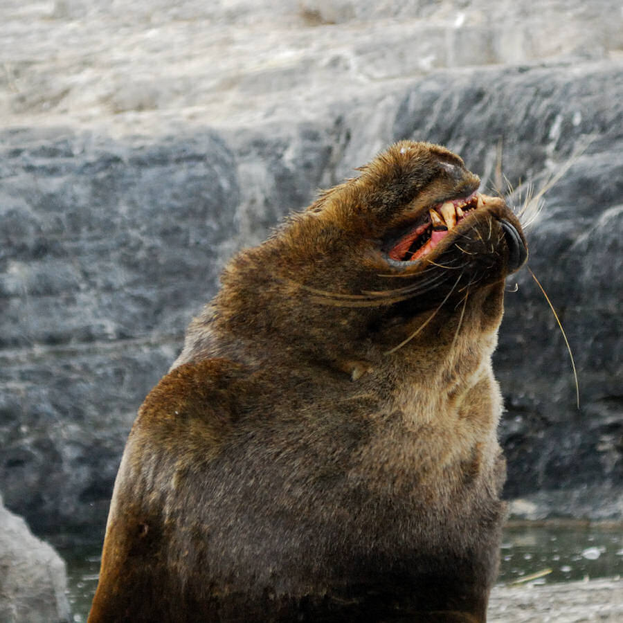
Sea Lions of the Beagle Channel
|
|
click image for a larger view |
click image for a larger view |
click image for a larger view |
click image for a larger view |
|
|
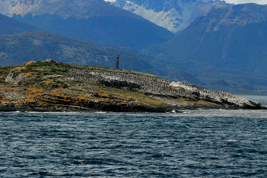
After more or less photographing Isla de los Lobos from all possible angles, we continued eastward on the Beagle Channel, our next destination Isla de Pajaros or Bird Island. Along the way, as you might expect, the scenery continued to be spectacular! Off in the distance to the east, you were starting to get teasing views of Isolete Les Eclaireurs where Faro Les Eclaireurs marks a dangerous navigational hazard in the Beagle Channel.
|
click image for a larger view |
 |
|
click image for a larger view |
click image for a larger view |
click image for a larger view |
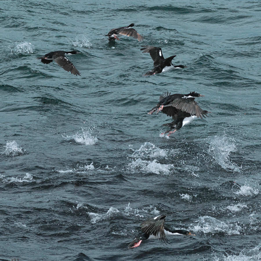
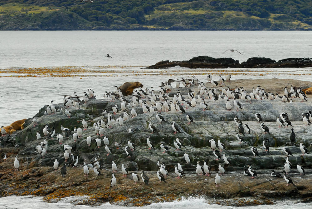
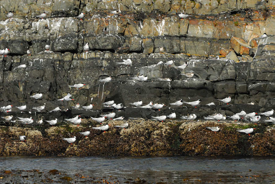
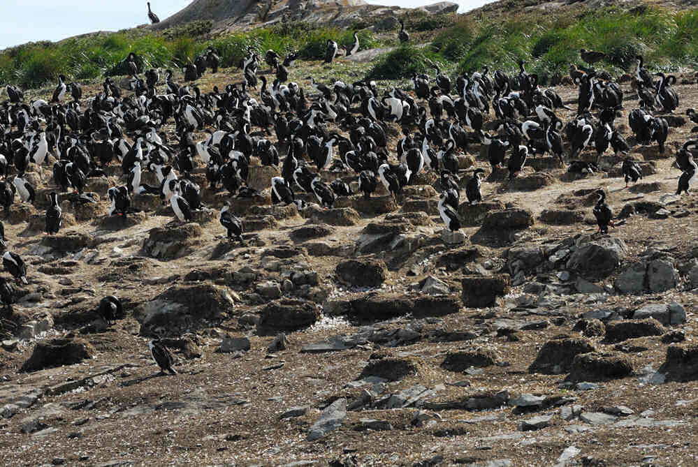
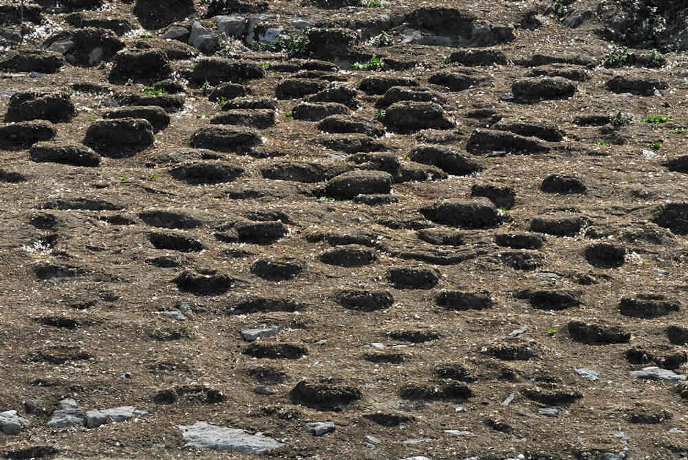
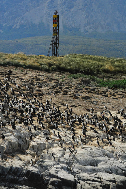
Rock cormorants were nesting on the steep rocky cliff sides of Isla de Pajaros and build the typical round nests that were common in the cormorant rookery on the island. The gulls took over their own segments of the cliffs for roosting or resting as in the photo below. |
|
|
click image for a larger view |
click image for a larger view |
Isla de Pajaros is beautifully colored from the lichens growing on the rocks. As we were cruising around the island, you turn a corner and are greeted by the sight of the cormorant rookery before, home to thousands of cormorants and their round, donut-like nests.
|
|
|
|
click image for a larger view |
click image for a larger view |
click image for a larger view |
click image for a larger view |
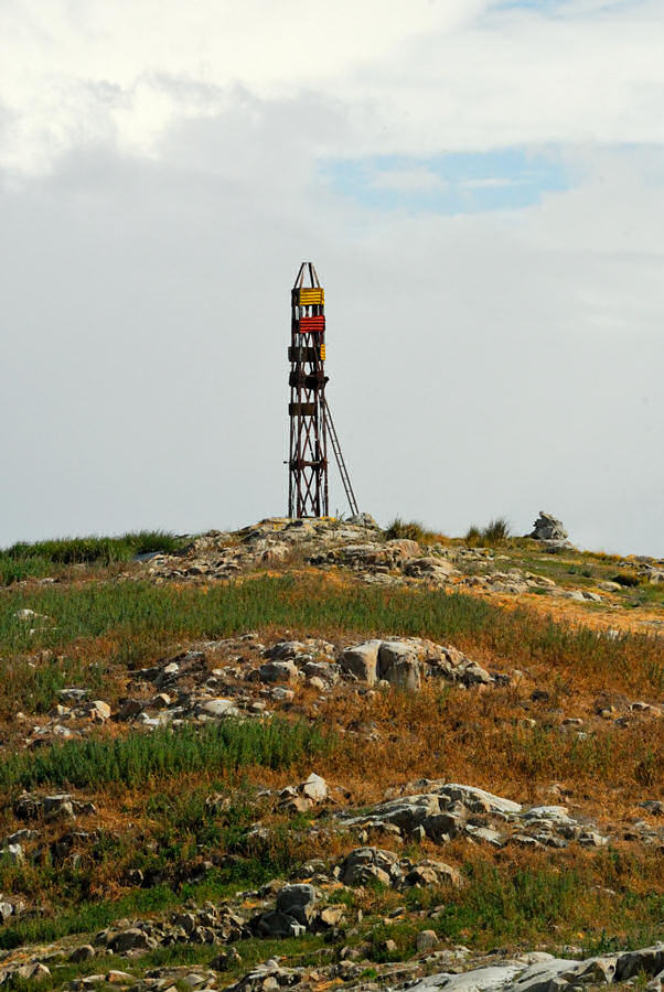
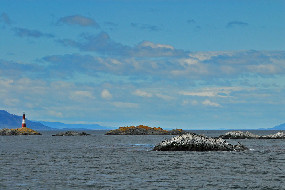
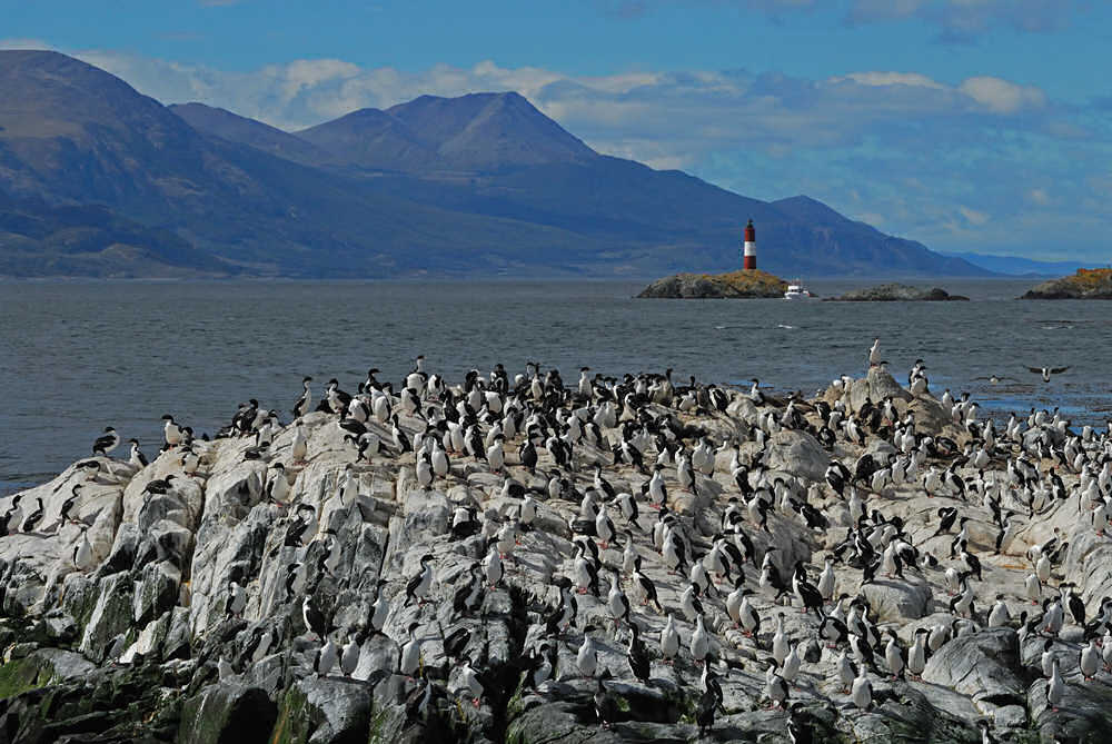
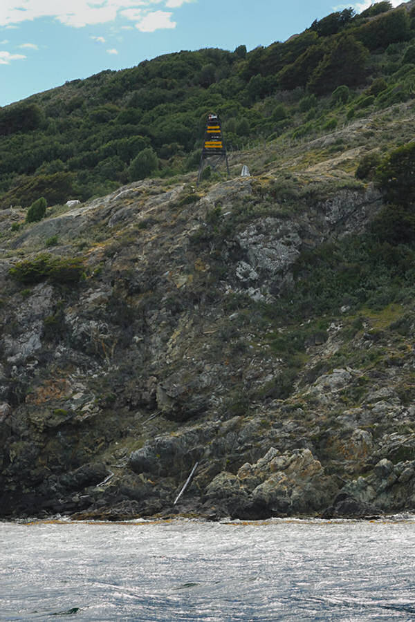
We left Isla de Pajaros and continued east toward the small group of islets where Faro Les Eclaireurs is located. It was itneresting to watch as the islet and lighthouse grew in size as we approached... Our route would take us to port relative to the photograph immediately below and then east toward the small islet that is on the left as you look at the image immediately below.
|
|


|
|
click image for a larger view |
click image for a larger view |
click image for a larger view |
click image for a larger view |
click image for a larger view |
click image for a larger view |
click image for a larger view
|
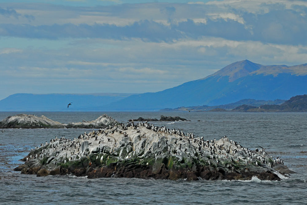
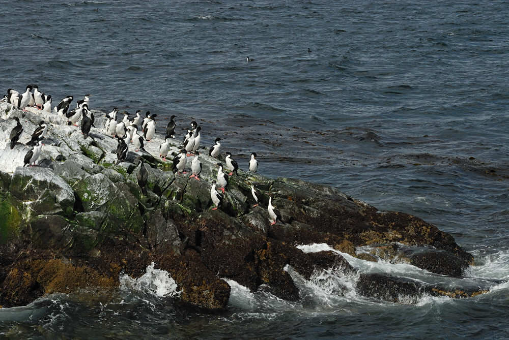
click image for a larger view The first islet the captain took us to was occupied by hundreds of cormorants, all of whom seemed to be completely oblivious to the boats full of camera-aiming tourists. There were also, of course, a few sea lions, including one who seemed to be a complete ham insofar as being conveniently posed for my lens!
|
|
|
click image for a larger view |
click image for a larger view |
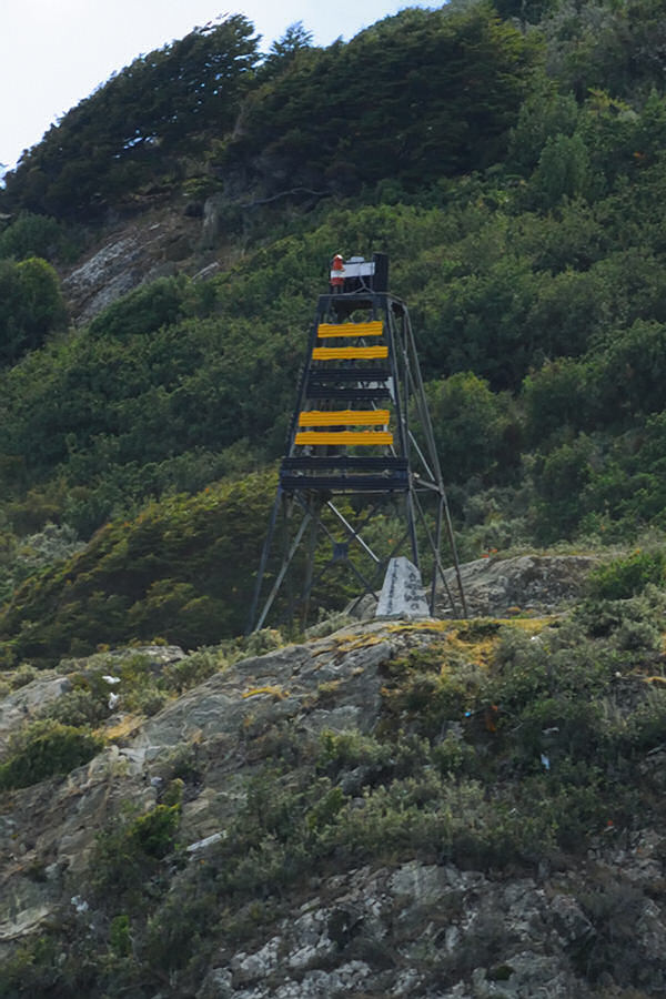
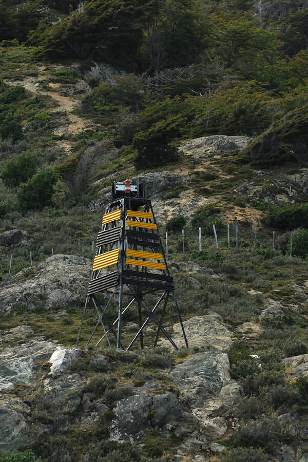
This view of Faro Les Eclaireurs was shot looking southeast. Isla Navarino, which belongs to Chile, is in the background. The road that you can see on the right side of the image that continues off to the east that you can barely see on the extreme left of the image goes to Puerto Williams.
|
|
click image for a larger view |
click image for a larger view |
click image for a larger view |
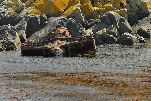
The rocky archipelago where Faro Les Esclaireur stands is also the watery grave of a German cruise liner, the Monte Cervantes that went down in 1930. The ship sailed at 9:00 PM from Ushuaia on January 22, 1930 with 350 crew and 1200 passengers. At 1:17 AM, the Monte Cervantes struck submerged rocks in an area known as Pan de Indio. She sank with the loss of only a single life... the captain, who elected to go to a watery grave with his ship.
To go to a page on the Shipwreck World website that gives more details of the sinking of the Monte Cervantes click the button above. The ship split in half. A portion of it is accessible for recreational divers but the remainder of the wreck now lies in water up to 330 feet deep which is too deep for recreational divers. All that remains of the Monte Cervantes above water is the bit of metal wreckage shown in the image below on the islet just south of the one on which Faro Les Eclaireurs stands. |
]
|
|


click image for a larger view |
click image for a larger view |
click image for a larger view |
click image for a larger view |
|
|
|
|
click image for a larger view
|
click image for a larger view
|
click image for a larger view |
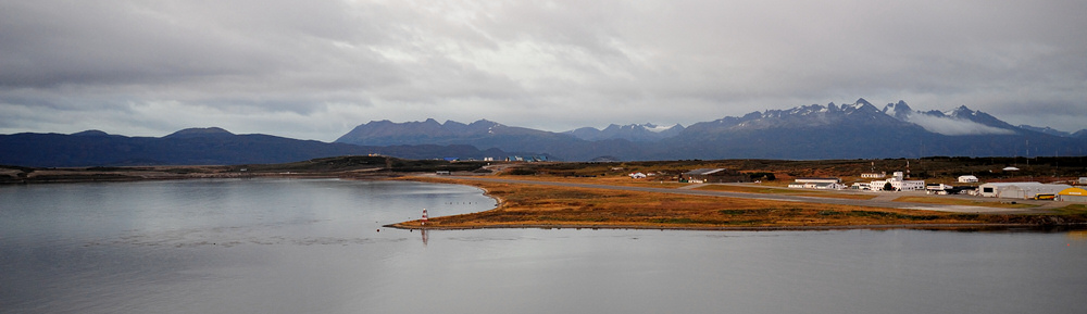
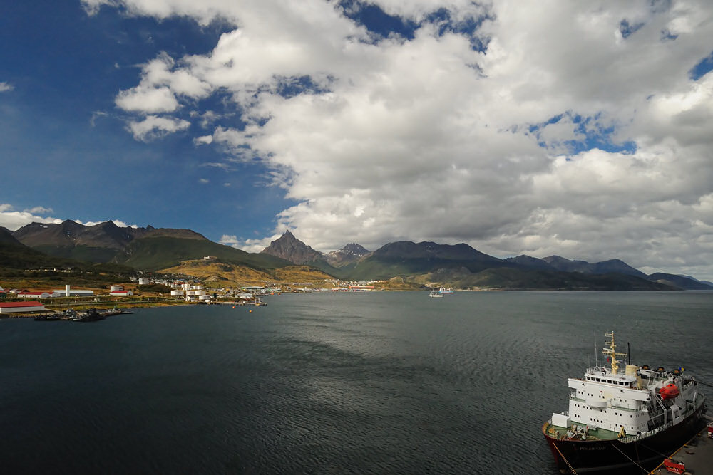
The Punto
Observatorio lighthouse stands beside Ushuaia's harbor near the
runway for the small local airport. The larger international
airport is on the other side of the ridge in the top photo. |


click image for a larger view |
click image for a larger view |
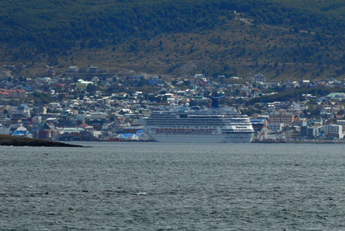
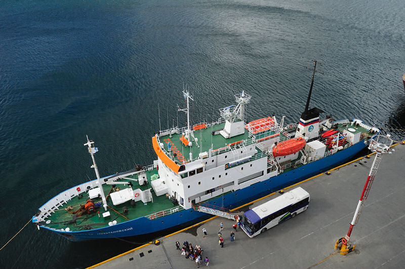
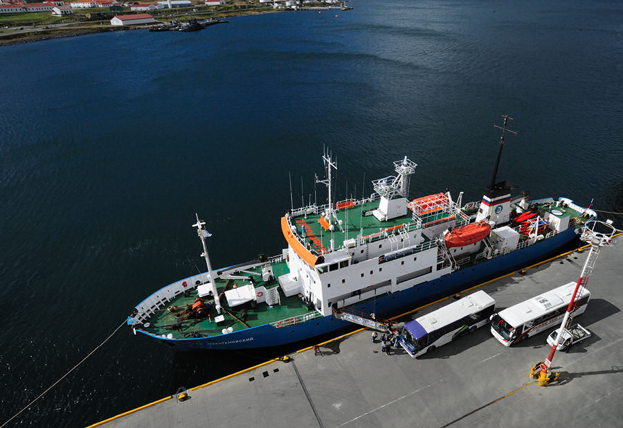
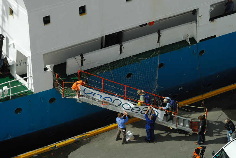
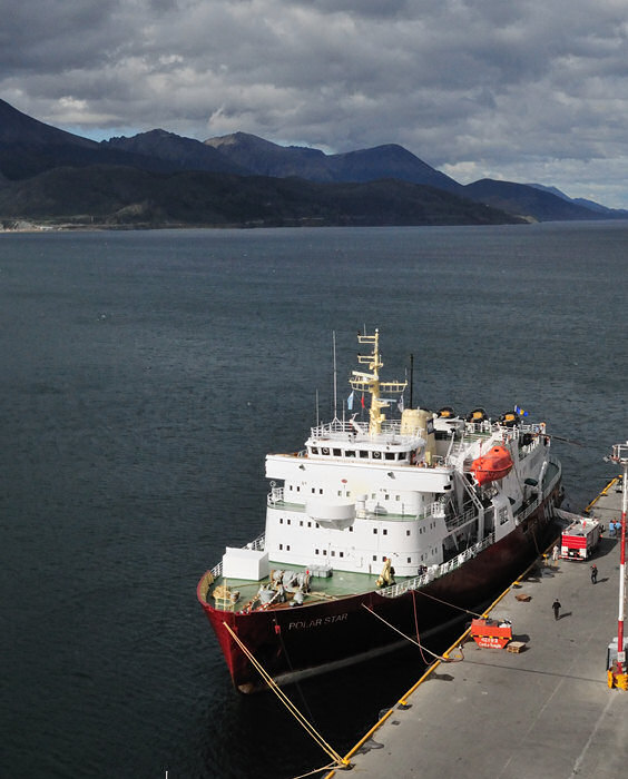
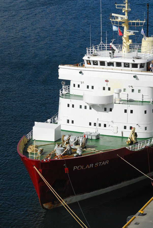
Ushuaia is
a jumping off point for travelers/adventurers departing for Cape
Horn, Isla de los Estados, and Antarctica. The vessels Professor
Multanovskiy and Polar Star were both moored at the pier in Ushuaia
when we returned from our trip on the Beagle Channel. Passengers
were just arriving to board the Professor Multanovskiy in the photo
to the right... posing for the group photo, and climbing the gangway.
Both vessels left that afternoon while we were still moored to the
pier. Despite the adventure we were having to say that I was
envious of the passengers of those two vessels would be an understatement. |
click image for a larger view
|
click image for a larger view |
click image for a larger view |
click image for a larger view |
click image for a larger view |
click image for an annotated view
|
|
click image for a larger view |
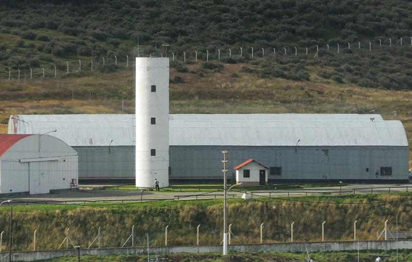
The Carnival
Capers, the ship's daily "newspaper" for Ushuaia listed
the Presidio of Ushuaia as having a lighthouse. In the photo
of the harbor above, the Presidio is on the extreme left and you
can see a white tower. A telephoto view of the tower is to
the left. I'm not sure if the Argentine Navy is building another
lighthouse for the Ushuaia harbor or not, but there may be another
lighthouse there to photograph the next time I make it to Ushuaia! |
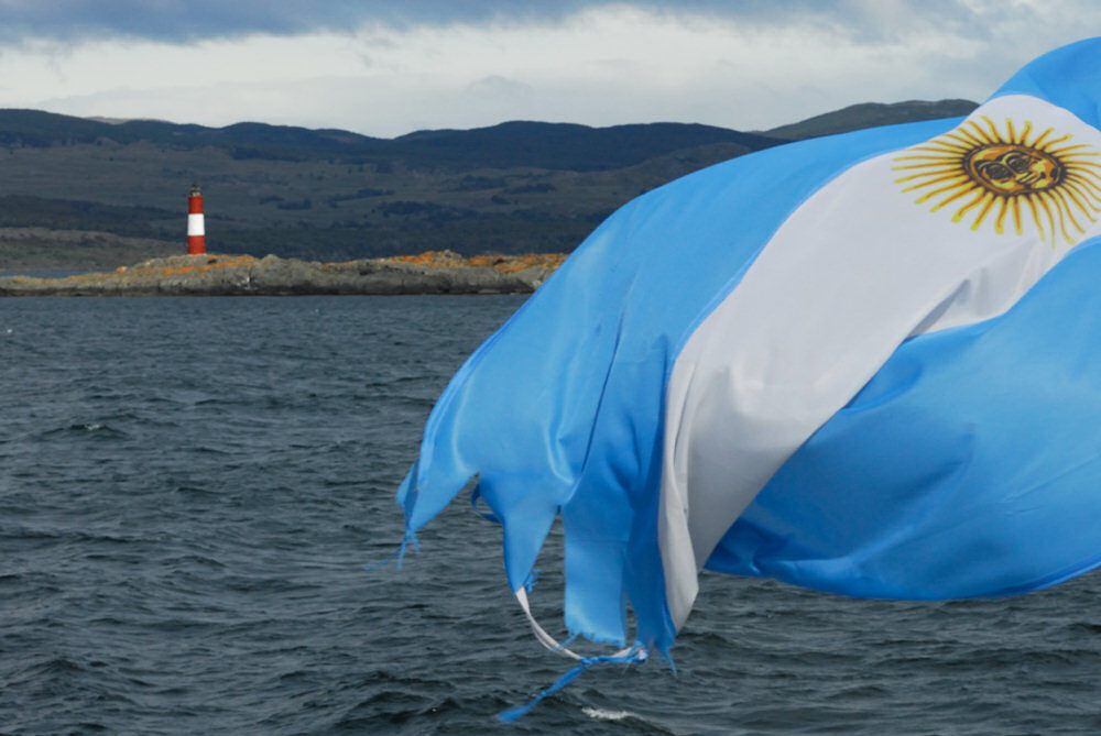
While we were out on the Beagle Channel during the afternoon, the winds blowing across the channel picked up and were sustained at about 40 knots from the southwest, which is exactly the wrong direction if you want to move a ship away from the pier that's moored to the south side of the pier. Our departure time was scheduled for 1600 hrs but that came and went. Dinner was at 1800 hrs and we finished dinner still moored to the pier. The winds continued blowing from the southwest and neither the Captain nor the pilot was inclined to try to move the Splendor away from the pier until they died down. They finally did and we were underway at about 2230 hrs, which, unfortunately, had ramifications for our day in Punta Arenas, Chile and the trip we had planned to Magdalena Island to see the penguin colony and the lighthouse. As we left Ushuaia, we sailed eastward, and turned around the Faro Les Eclaireurs light so I got to see it's flash as we rounded the lighthouse when we turned to the west to along the Beagle Channel. Punta Arenas is a tender port for ships the size of the Splendor. About the only folks being tendered anywwhere when we got there, however, were Chilean immigration officials and some of the performers leaving the ship and others boarding the ship for the next leg of our journey. That wraps up this segment of the trip. The next segment will cover the segment of the trip from Ushuaia to Punta Arenas. The route, to say the least was spectacular and I would have loved to be able to see all of it in the daylight. |
 |
 |
 |
 |
 |
 |
 |
 |