|
Leaving Golfo
Nuevo and Puerto Madryn behind, we again sailed out into the open
waters of the South Atlantic before turning to starboard to again
parallel the coast of Argentina to head south toward the Estrecho
de le Maire, the strait that separatets the tip of Tierra del
Fuego from Isla de los Estados to the east.
|
After
departing Golfo Nuevo between the Punta Ninfas and Faro
Morro Nuevo lights at the mouth of the gulf we made our
way out into the South Atlantic and for the next approximately
36 hrs we sailed in a southerly direction.
We
were out of sight of land most of the time and one had
the horizon or the cloudscapes to watch. As we went
further south, the clouds became heavier and thicker.
At first the sky was blue punctuated by patches of clouds
that drifted overhead. As the first day at sea wore
on, the sky became mostly cloudy punctuated with patches
of blue.
We
spent a good bit of time in the Cloud 9 spa that day in
a giant hot tub, the motion of the Splendor causing a
small wave to roll back and forth along the length of
the hot tub. Lying in the warm waters, the wave
gently moving you to and fro as it washed back and forth
did allow your mind to drift... Cloud 9 was probably
an excellent choice for the name of that spa!
|
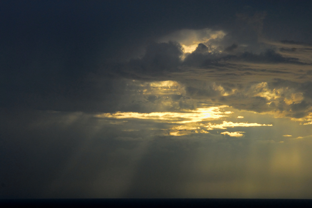
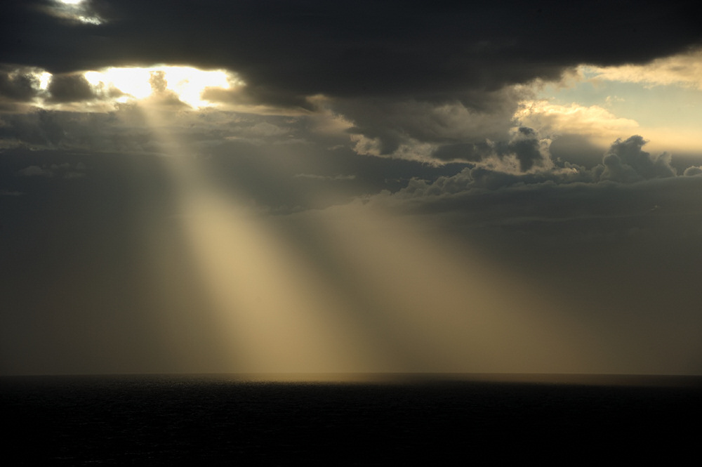
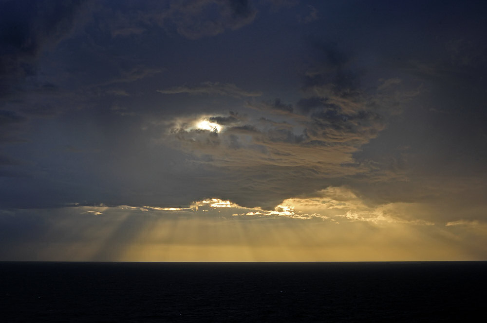
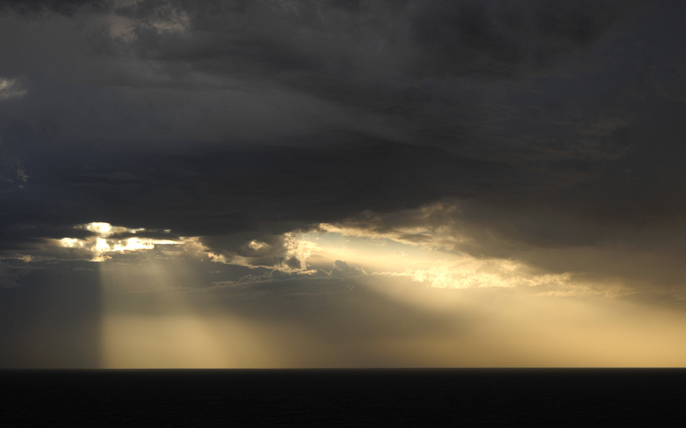
Looking west
from the balcony of our stateroom in the late afternoon as time
was moving toward dinner, the sky was heavily overcast.
Periodically there were bright spots in the cloud where you could
see a dim sun. Those bright spots eventually gave way to
patches of sky where you could see blue through openings and in
some case there were spectacular crepuscular rays streaming down
through gaps in the clouds to light the waters of the South Atlantic
beneath the clouds..
|
|
|
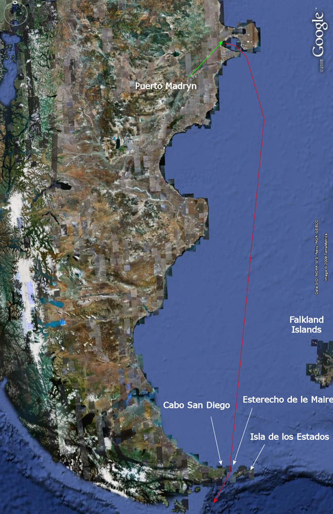
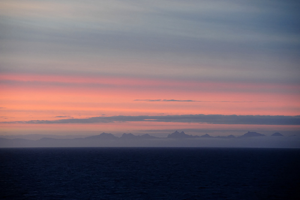
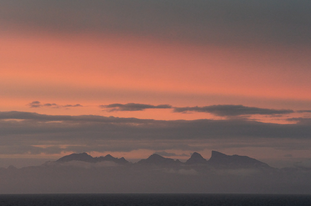
The image just below
is probably my favorite cloudscape as we were making our
way southward to the entrance to Estrecho de Le Maire.
It is a single exposure... everything came together
and just worked in that image as far as I was concerned.
|
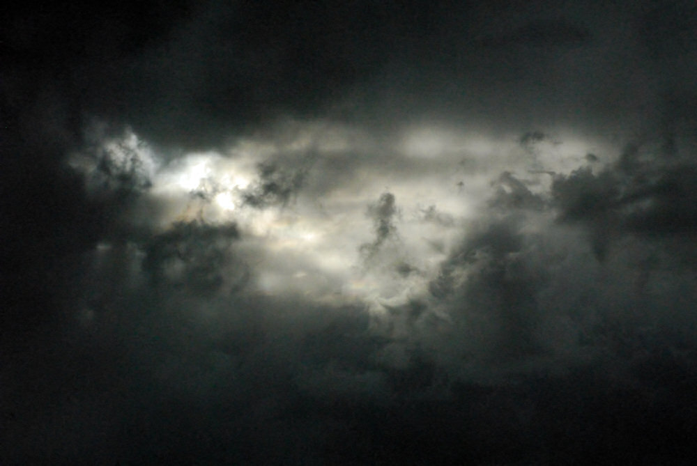
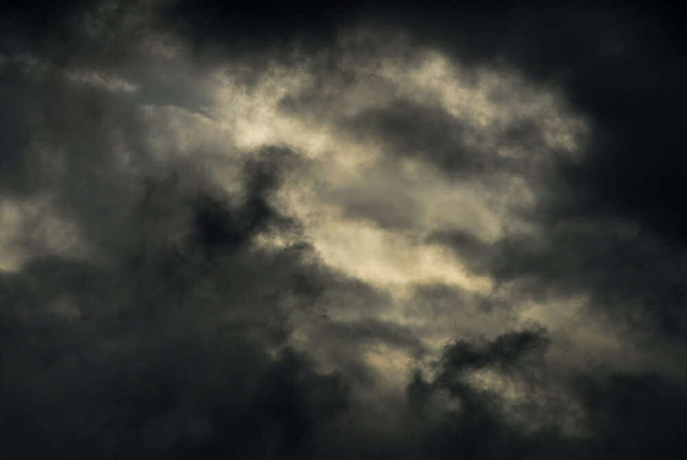
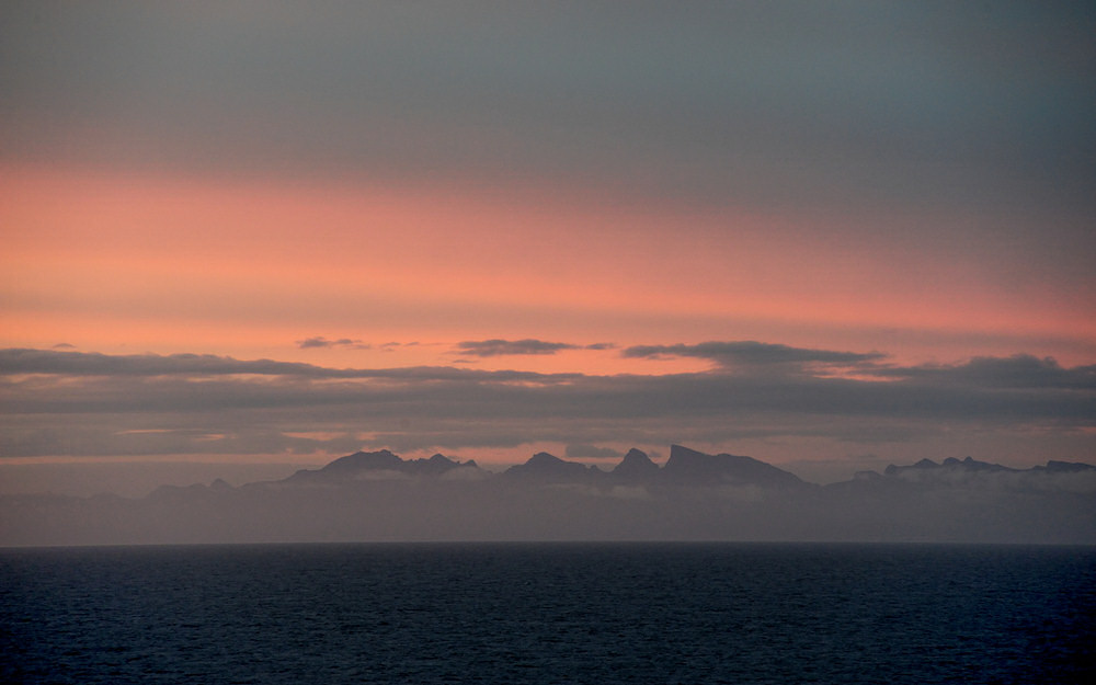
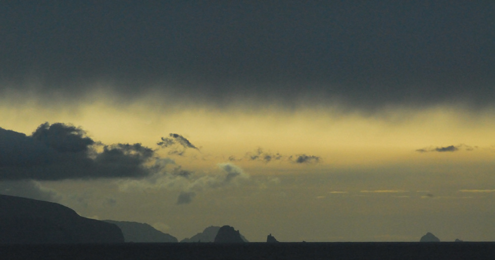
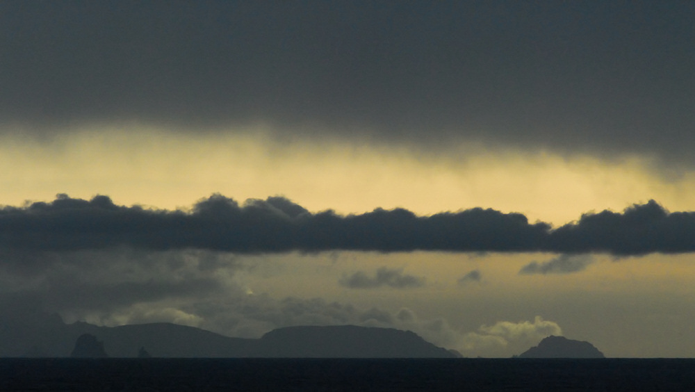
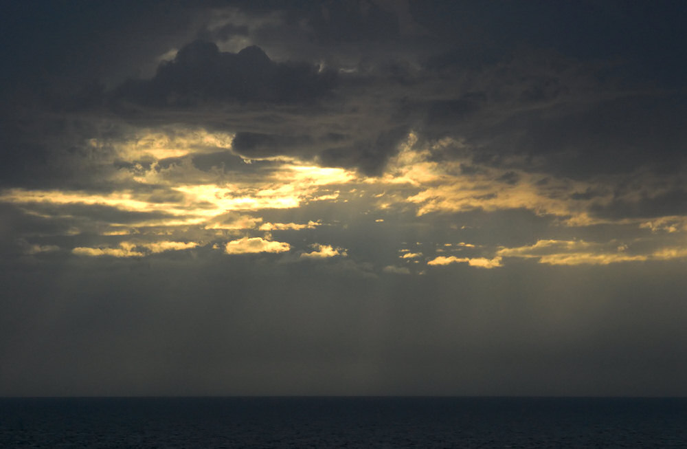
The two images below
were more complex undertakings. These are HDR or
High Dynamic Range images that were both prepared by combining
five individual exposures of the same cloudscape shot
back to back. Both of these HDR images were prep'd
from images with values of +1.3, +0.7, 0.0, -0.7, and
-1.3 EV. In both cases, single exposures were incapable
of capturing the range of light and the texture in the
darker regions of the image. I'm by no means a master
when it comes to doing HDR images, but these were fun
to try.
|
And so it went that
afternoon... one cloudscape dissolved into another,
and then another... I quit shooting when it was
time for dinner and we wandered down to our table on the
port side of the ship. There wasn't much of a sunset
to miss that evening.
|
click photo for a larger view
|
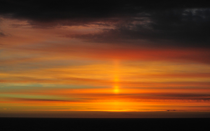
I was up well before
dawn the next morning in anticipation of our entry into
Estrecho de le Maire and the possibility of seeing off
in the distance the lighthouse at Cabo San Diego on the
tip of Tierra del Fuego to the west or the small Faro
le Maire light on the west end of Isla de los Estados
to the east.
Before the mountains
of Isla de los Estados or the Cabo San Diego headlands
came into view, however, the predawn offered up a treat
for those who were awake and out on their balconies on
the port side of the ship or up on the upper decks...
a sun pillar!
|
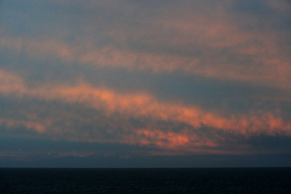
As a photographer,
you sometimes need to remind yourself to look away from
the sunrise or the sunset to see what's going on behind
your back. At times that can be even more interesting
and potentially more colorful than the event that you're
photographing.
The clouds to the
west that morning weren't outrageously spectacular or
anything, but the color that they were carrying from the
sunrise was beautiful none-the-less.
|
click photo for a larger view
|
click for Wikipedia page
|
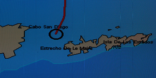
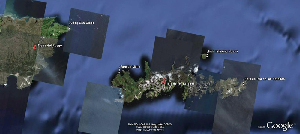
The top satellite
image above from Google shows the tip of Tierra del Fuego
to the west and Isla de los Estados to the east.
These two land masses are separated by Estrecho de Le
Maire. The distance from Cabo San Diego to the Faro
Le Maire on Bahia Crossley is approx. 20 miles.
Estrecho de Le Maire was discovered by the explorers Jacob
Le Maire and Willem Schouten on January 26th, 1616.
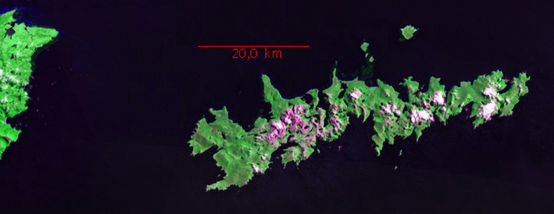
The bottom satellite image is from NASA's World Wind globe
software.
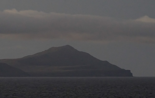
A distant early morning
photo of Cabo San Diego is shown to the right. The
Cabo Sand Diego lighthouse is located approximately in
the flat spot atop the bluffs to the right of the land
mass.
|
|
One
of the interesting features on the ship was the continually
updated ship's position on the flat screen in everyone's
cabin. You could walk out onto your balcony, photograph
something, and then walk back in and take a look at the
monitor and know exactly where you were. The photograph
to the right shows were the ship was located when the shot
of Cabo San Diego above and the photographs of Isla de los
Estados below were shot. |
|
I was struck
by the tremendous changes in lighthing and contrast that occured
in just a few minutes while looking and photographing to the east
and Isla de los Estados. The image above was shot after
the sunrise images below characerized by soft pastels. When
the images below were shot, I was aiming my lens more or less
to the southeast. The image above was shot due east when
the sun was well above the horizon.
|
|
The photograph above
is a wide angle view of the sunrise over the mountainous
backbone of Isla de los Estados. The entire island
is now set aside as an ecological preserve. The
photographs below were shot at focal lengths of 300 and
900 mm.
|
|
|
|
|
The dawn images above
were all shot with telephoto lenses at focal lengths that
varied out to 600 mm. The image below was shot some
minutes later and shows all of the breadth of Isla de
los Estados in a fisheye view of the eastern horizon.
As you can see, the clouds were darkening overhead as
we made our way further south.
As we passed through
Estrecho de Le Maire, unfortunately, low hanging clouds
blocked any chance of a clear view of the small light
that replaced the original Faro Le Maire located at Bahia
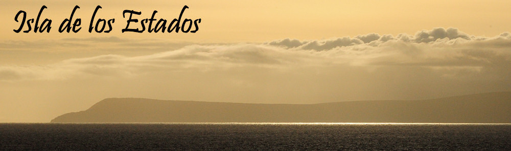
Crossley on the western end of the island. Isla
de los Estados, an island approximately 40 miles in length
by 9 miles wide has an extremely mountainous backbone
and has been entirely set aside as a provincial ecological
preserve. Ecoadventure tours can be taken to Isla
de los Estados from Ushuaia. The only full time
inhabitation on the island is a small naval station with
a rotating staff.
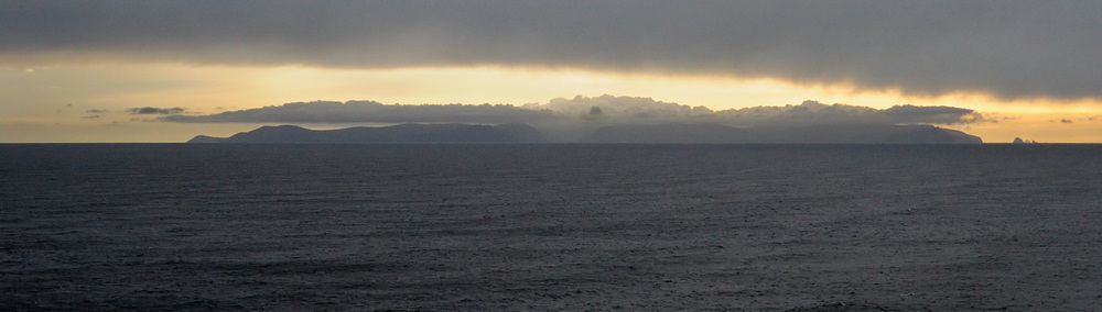
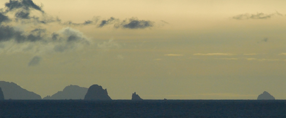
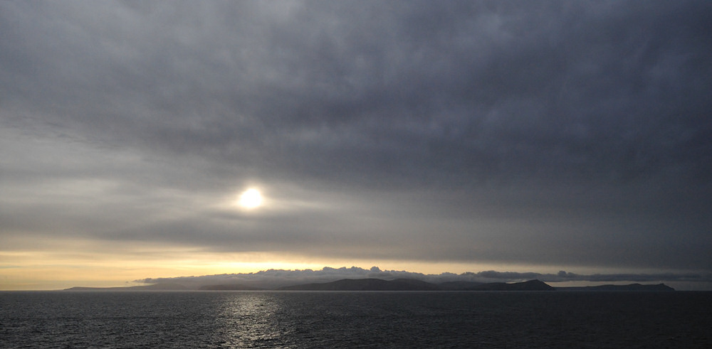
Emerging from the
southern end of Estrecho de Le Maire, looking east I was
taken by the vista that unfolded with the sea stacks if
one can call them that sticking up out of the cold waters
of the South Atlantic off the south flank of Isla de los
Estados with the somewhat meacing looking sky and clouds
aloft in the images below.
|
|
|
|
|
|
|
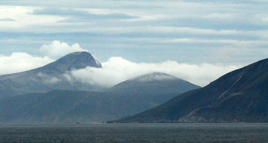
When
the photographs above were shot, the vessel had turned toward
the south west and was paralleling the coast of Tierra del
Fuego. The landscape, despite being miles away was
still dynamic and you could watch clouds spilling through
the openings between the mountains, flowing down the eastern
flanks toward the waters of the Beagle Channel and the South
Atlantic. |
|
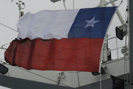
At
some point not too long after the photos above were shot,
a member of the crew changed the flag that the Splendor
was flying from the Argentine to the Chilean flag and we
knew that we were in Chilean waters for the first time and
headed toward the Hermite Archipelago and Cape Horn! |
|
|
|
... which brings this segment to
a close... sorry no sunset for this portion of the journey!
|