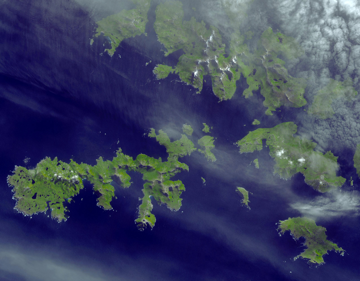
Satellite image of the Hermite Group of islands. Isla de Hornos is in the lower right corner of the image.
Description=Satellite image of the w:Hermite Islands and w:Cape Horn. | Source=http://earthobservatory.nasa.gov/Newsroom/NewImages/images.php3?img_id=17271 | Date=September 20, 2005 | Author=NASA/GSFC/METI/ERSDAC/JAROS, and U.S./Ja)
Click HERE to be taken to the Wikipedia source page for the image above.
All images are Copyrighted by Gary Martin, 1996-2009. No images can be downloaded or used for any purpose without premission in writing from the copyright holder.